Ursk geodata
Ursk (Kemerovo Oblast) is a populated place; located in Russia in Asia/Novokuznetsk (GMT+7) time zone. With population of 1,700 people, there are 4290 cities with bigger population in this country. Compared to other cities in Russia, 51.4% of cities are located further ↑North; 82.6% of cities are located further ←West and 86.8% of cities have lower elevation than Ursk. Note1


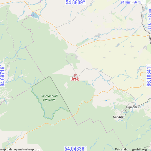
Ursk GPS coordinates[2]
54° 27' 15.012" North, 85° 24' 1.008" East
| Map corner | latitude | longitude |
|---|---|---|
| Upper-left | 54.8609°, | 84.69716° |
| Center: | 54.45417°, | 85.40028° |
| Lower-right: | 54.04336°, | 86.10341° |
| Map W x H: | 90.9×90.9 km | = 56.5×56.5mi |
| max Lat: | 73.50819° ⇑51.4% North |
| Ursk: | 54.45417° |
| min Lat: | ⇓48.6% South 41.28413° |
| min Long | Ursk | max Long |
| -179.12198° | 85.40028° | 179.35046° |
| W 82.6%⇐ | ⇒17.4% E |
Elevation
Elevation of Ursk is 363 m = 1191 ft, and this is 160.4 m = 526 ft above average elevation for this country.
| Max E: |
2518 m = 8261 ft | 13.2% |
| Ursk | 363 m 1191 ft | |
| Avg. | 202.6 m = 665 ft | |
Min E: |
-28 m = -92 ft | 86.8% |
See also: Russia elevation on elevation.city.
Geographical zone
Ursk is located in North temperate zone (between Tropic of Cancer and the Arctic Circle). Distance of this North polar circle is 1346.4 km =836.6 mi to North.| Distance of | km | miles | from Ursk |
|---|---|---|---|
| North Pole | 3952.3 | 2455.8 | to North |
| Arctic Circle | 1346.4 | 836.6 | to North |
| Tropic Cancer | 3448.8 | 2143 | to South |
| Equator | 6054.7 | 3762.2 | to South |


Nearby cities:
15 places around Ursk: (largest is in red/bold)
• Bachatskiy
50.5 km =31.4 mi,  110°
110°
• Belovo
58.2 km =36.2 mi,  94°
94°
• Gorskino
14.8 km =9.2 mi,  84°
84°
• Gramoteino
64.2 km =39.9 mi, 81°
• Gur’yevsk
39.4 km =24.5 mi,  118°
118°
• Krasnogorskiy
57.8 km =35.9 mi, 79°
• Krasnoye
17 km =10.6 mi,  357°
357°
• Leninsk-Kuznetsky
54.7 km =34 mi,  65°
65°
• Nikitinskiy
42 km =26.1 mi, 69°
• Novopesterevo
22 km =13.7 mi, 93°
• Polysayevo
57 km =35.4 mi, 73°
• Promyshlennaya
53.6 km =33.3 mi,  16°
16°
• Salair
35.7 km =22.2 mi,  133°
133°
• Starobachaty
57.3 km =35.6 mi, 114°
• Zhuravlevo
42.7 km =26.5 mi,  329°
329°
Sources, notices
• [Note1] Compared only with cities in Russia existing in our database
• [Src1] Map data: © OpenStreetMap contributors (CC-BY-SA)
• [Src2] Other city data from geonames.org with taken over terms of usage.
• [Src3] Geographical zone / Annual Mean Temperature by Robert A. Rohde @ Wikipedia
