Promyshlennaya geodata
Promyshlennaya (Kemerovo Oblast) is a populated place; located in Russia in Asia/Novokuznetsk (GMT+7) time zone. With population of 17,216 people, there are 990 cities with bigger population in this country. Compared to other cities in Russia, 52.4% of cities are located further ↓South; 82.9% of cities are located further ←West and 64.6% of cities have lower elevation than Promyshlennaya. Note1


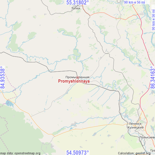
Promyshlennaya GPS coordinates[2]
54° 54' 57.24" North, 85° 38' 18.6" East
| Map corner | latitude | longitude |
|---|---|---|
| Upper-left | 55.31802°, | 84.93538° |
| Center: | 54.9159°, | 85.6385° |
| Lower-right: | 54.50973°, | 86.34163° |
| Map W x H: | 89.9×89.9 km | = 55.9×55.9mi |
| max Lat: | 73.50819° ⇑47.6% North |
| Promyshlennaya: | 54.9159° |
| min Lat: | ⇓52.4% South 41.28413° |
| min Long | Promyshlennaya | max Long |
| -179.12198° | 85.6385° | 179.35046° |
| W 82.9%⇐ | ⇒17.1% E |
Elevation
Elevation of Promyshlennaya is 181 m = 594 ft, and this is 21.6 m = 71 ft below average elevation for this country.
| Max E: |
2518 m = 8261 ft | 35.4% |
| Avg. | 202.6 m = 665 ft | |
| Promyshlennaya | 181 m = 594 ft | |
Min E: |
-28 m = -92 ft | 64.6% |
See also: Russia elevation on elevation.city.
Geographical zone
Promyshlennaya is located in North temperate zone (between Tropic of Cancer and the Arctic Circle). Distance of this North polar circle is 1295.1 km =804.7 mi to North.| Distance of | km | miles | from Promyshlennaya |
|---|---|---|---|
| North Pole | 3901 | 2424 | to North |
| Arctic Circle | 1295.1 | 804.7 | to North |
| Tropic Cancer | 3500.2 | 2174.9 | to South |
| Equator | 6106.1 | 3794.2 | to South |


Nearby cities:
15 places around Promyshlennaya: (largest is in red/bold)
• Gorskino
49.9 km =31 mi,  180°
180°
• Kemerovo
54.4 km =33.8 mi,  31°
31°
• Krasnogorskiy
58.2 km =36.2 mi,  134°
134°
• Krasnoye
37.9 km =23.5 mi,  204°
204°
• Leninsk-Kuznetsky
44.8 km =27.8 mi, 130°
• Nikitinskiy
43.9 km =27.3 mi,  146°
146°
• Novopesterevo
53 km =32.9 mi,  172°
172°
• Pioner
48.8 km =30.3 mi,  24°
24°
• Plotnikovo
22.9 km =14.2 mi,  58°
58°
• Polysayevo
52.4 km =32.6 mi, 131°
• Topki
40.2 km =25 mi,  357°
357°
• Ursk
53.6 km =33.3 mi, 196°
• Yagunovo
43.7 km =27.2 mi, 32°
• Yagunovskiy
46.2 km =28.7 mi, 27°
• Zhuravlevo
39.7 km =24.7 mi,  248°
248°
Sources, notices
• [Note1] Compared only with cities in Russia existing in our database
• [Src1] Map data: © OpenStreetMap contributors (CC-BY-SA)
• [Src2] Other city data from geonames.org with taken over terms of usage.
• [Src3] Geographical zone / Annual Mean Temperature by Robert A. Rohde @ Wikipedia
