Zhuravlevo geodata
Zhuravlevo (Kemerovo Oblast) is a populated place; located in Russia in Asia/Novokuznetsk (GMT+7) time zone. With population of 900 people, there are 4696 cities with bigger population in this country. Compared to other cities in Russia, 51.1% of cities are located further ↓South; 82.3% of cities are located further ←West and 66.8% of cities have lower elevation than Zhuravlevo. Note1


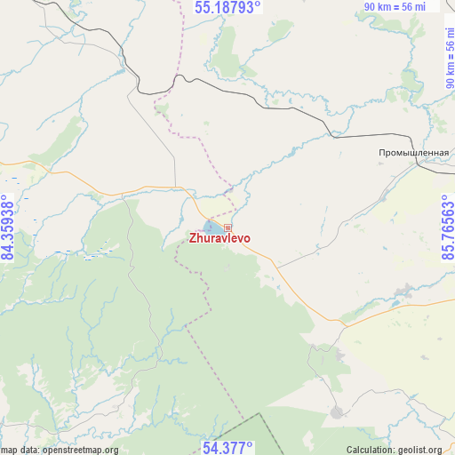
Zhuravlevo GPS coordinates[2]
54° 47' 4.2" North, 85° 3' 45" East
| Map corner | latitude | longitude |
|---|---|---|
| Upper-left | 55.18793°, | 84.35938° |
| Center: | 54.7845°, | 85.0625° |
| Lower-right: | 54.377°, | 85.76563° |
| Map W x H: | 90.2×90.2 km | = 56×56mi |
| max Lat: | 73.50819° ⇑48.9% North |
| Zhuravlevo: | 54.7845° |
| min Lat: | ⇓51.1% South 41.28413° |
| min Long | Zhuravlevo | max Long |
| -179.12198° | 85.0625° | 179.35046° |
| W 82.3%⇐ | ⇒17.7% E |
Elevation
Elevation of Zhuravlevo is 187 m = 614 ft, and this is 15.6 m = 51 ft below average elevation for this country.
| Max E: |
2518 m = 8261 ft | 33.2% |
| Avg. | 202.6 m = 665 ft | |
| Zhuravlevo | 187 m = 614 ft | |
Min E: |
-28 m = -92 ft | 66.8% |
See also: Russia elevation on elevation.city.
Geographical zone
Zhuravlevo is located in North temperate zone (between Tropic of Cancer and the Arctic Circle). Distance of this North polar circle is 1309.7 km =813.8 mi to North.| Distance of | km | miles | from Zhuravlevo |
|---|---|---|---|
| North Pole | 3915.6 | 2433 | to North |
| Arctic Circle | 1309.7 | 813.8 | to North |
| Tropic Cancer | 3485.5 | 2165.8 | to South |
| Equator | 6091.5 | 3785.1 | to South |


Nearby cities:
15 places around Zhuravlevo: (largest is in red/bold)
• Gorskino
50.7 km =31.5 mi,  134°
134°
• Gur’yevsk
79.1 km =49.2 mi, 134°
• Krasnoye
28.9 km =18 mi, 133°
• Leninsk-Kuznetsky
72.8 km =45.2 mi,  101°
101°
• Maslyanino
73.6 km =45.7 mi,  228°
228°
• Nikitinskiy
64.9 km =40.3 mi,  110°
110°
• Novopesterevo
57.8 km =35.9 mi, 131°
• Plotnikovo
62.3 km =38.7 mi,  64°
64°
• Polysayevo
78.7 km =48.9 mi, 105°
• Promyshlennaya
39.7 km =24.7 mi,  68°
68°
• Salair
77.7 km =48.3 mi,  142°
142°
• Toguchin
66.1 km =41.1 mi,  319°
319°
• Topki
65.1 km =40.5 mi,  32°
32°
• Ursk
42.7 km =26.5 mi,  149°
149°
• Yagunovo
79.3 km =49.3 mi,  49°
49°
Sources, notices
• [Note1] Compared only with cities in Russia existing in our database
• [Src1] Map data: © OpenStreetMap contributors (CC-BY-SA)
• [Src2] Other city data from geonames.org with taken over terms of usage.
• [Src3] Geographical zone / Annual Mean Temperature by Robert A. Rohde @ Wikipedia
