Ha'il geodata
Ha'il (Ḩāʼil) is a seat of a first-order administrative division; located in Saudi Arabia in Asia/Riyadh (GMT+3) time zone. With population of 267,005 people, there are 14 cities with bigger population in this country. Compared to other cities in Saudi Arabia, 88.7% of cities are located further ↓South; 74.2% of cities are located further →East and 85.6% of cities have lower elevation than Ha'il. Note1


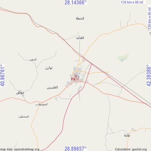
Ha'il GPS coordinates[2]
27° 31' 18.768" North, 41° 41' 26.628" East
| Map corner | latitude | longitude |
|---|---|---|
| Upper-left | 28.14366°, | 40.98761° |
| Center: | 27.52188°, | 41.69073° |
| Lower-right: | 26.89657°, | 42.39386° |
| Map W x H: | 138.7×138.7 km | = 86.2×86.2mi |
| max Lat: | 31.67252° ⇑11.3% North |
| Ha'il: | 27.52188° |
| min Lat: | ⇓88.7% South 16.57946° |
| min Long | Ha'il | max Long |
| 35.69014° | 41.69073° | 54.09599° |
| W 25.8%⇐ | ⇒74.2% E |
Elevation
Elevation of Ha'il is 1002 m = 3287 ft, and this is 480.6 m = 1577 ft above average elevation for this country.
| Max E: |
2385 m = 7825 ft | 14.4% |
| Ha'il | 1002 m 3287 ft | |
| Avg. | 521.4 m = 1711 ft | |
Min E: |
3 m = 10 ft | 85.6% |
See also: Ha'il elevation on elevation.city.
Geographical zone
Ha'il is located in North temperate zone (between Tropic of Cancer and the Arctic Circle). Distance of this Northern Tropic circle is 454.2 km =282.2 mi to South.| Distance of | km | miles | from Ha'il |
|---|---|---|---|
| North Pole | 6946.9 | 4316.6 | to North |
| Arctic Circle | 4341 | 2697.4 | to North |
| Tropic Cancer | 454.2 | 282.2 | to South |
| Equator | 3060.1 | 1901.5 | to South |


Nearby cities:
15 places around Ha'il: (largest is in red/bold)
• Adh Dhibiyah
220.9 km =137.3 mi,  138°
138°
• Ain AlBaraha
371 km =230.5 mi,  145°
145°
• Al Arţāwīyah
379.5 km =235.8 mi,  107°
107°
• Al Bukayrīyah
248.4 km =154.3 mi,  128°
128°
• Al Fuwayliq
195.7 km =121.6 mi, 127°
• Al Mithnab
312.1 km =193.9 mi, 126°
• Alrmtheiah
333.8 km =207.4 mi,  157°
157°
• Ar Rass
256.8 km =159.6 mi, 135°
• Az Zulfī
338.3 km =210.2 mi, 113°
• Buraydah
262.6 km =163.2 mi,  120°
120°
• Sakakah
308.2 km =191.5 mi,  332°
332°
• Tanūmah
245.8 km =152.7 mi,  101°
101°
• Unaizah
276.2 km =171.6 mi, 125°
• Wed Alnkil
259.3 km =161.1 mi, 153°
• Şuwayr
315.2 km =195.9 mi,  336°
336°
Sources, notices
• [Note1] Compared only with cities in Saudi Arabia existing in our database
• [Src1] Map data: © OpenStreetMap contributors (CC-BY-SA)
• [Src2] Other city data from geonames.org with taken over terms of usage.
• [Src3] Geographical zone / Annual Mean Temperature by Robert A. Rohde @ Wikipedia
