Torshälla geodata
Torshälla (Södermanland) is a populated place; located in Sweden in Europe/Stockholm (GMT+2) time zone. With population of 8,928 people, there are 167 cities with bigger population in this country. Compared to other cities in Sweden, 64.5% of cities are located further ↓South; 68% of cities are located further ←West and 84.8% of cities have higher elevation than Torshälla. Note1


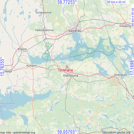
Torshälla GPS coordinates[2]
59° 25' 0.012" North, 16° 28' 0.012" East
| Map corner | latitude | longitude |
|---|---|---|
| Upper-left | 59.77253°, | 15.76355° |
| Center: | 59.41667°, | 16.46667° |
| Lower-right: | 59.05703°, | 17.1698° |
| Map W x H: | 79.6×79.6 km | = 49.5×49.5mi |
| max Lat: | 67.85572° ⇑35.5% North |
| Torshälla: | 59.41667° |
| min Lat: | ⇓64.5% South 55.34337° |
| min Long | Torshälla | max Long |
| 11.1712° | 16.46667° | 24.13676° |
| W 68%⇐ | ⇒32% E |
Elevation
Elevation of Torshälla is 13 m = 43 ft, and this is 69.6 m = 228 ft below average elevation for this country.
| Max E: |
663 m = 2175 ft | 84.8% |
| Avg. | 82.6 m = 271 ft | |
| Torshälla | 13 m = 43 ft | |
Min E: |
-1 m = -3 ft | 15.2% |
See also: Sweden elevation on elevation.city.
Geographical zone
Torshälla is located in North temperate zone (between Tropic of Cancer and the Arctic Circle). Distance of this North polar circle is 794.7 km =493.8 mi to North.| Distance of | km | miles | from Torshälla |
|---|---|---|---|
| North Pole | 3400.5 | 2113 | to North |
| Arctic Circle | 794.7 | 493.8 | to North |
| Tropic Cancer | 4000.6 | 2485.9 | to South |
| Equator | 6606.5 | 4105.1 | to South |


Nearby cities:
15 places around Torshälla: (largest is in red/bold)
• Barkarö
14.9 km =9.3 mi,  8°
8°
• Dingtuna
17.9 km =11.1 mi,  345°
345°
• Enhagen-Ekbacken
16.9 km =10.5 mi, 12°
• Eskilstuna
6 km =3.7 mi,  157°
157°
• Horn
13.9 km =8.6 mi,  311°
311°
• Hällberga
13.4 km =8.3 mi,  145°
145°
• Hällbybrunn
3.8 km =2.4 mi,  221°
221°
• Hållsta
13.6 km =8.5 mi,  182°
182°
• Kjulaås
11.9 km =7.4 mi,  108°
108°
• Kungsör
20.9 km =13 mi,  271°
271°
• Kvicksund
9.1 km =5.7 mi,  294°
294°
• Skillinge
19.8 km =12.3 mi, 272°
• Skogstorp
10.3 km =6.4 mi,  174°
174°
• Strömsholm
17.6 km =10.9 mi, 314°
• Ärla
19.4 km =12.1 mi,  141°
141°
Sources, notices
• [Note1] Compared only with cities in Sweden existing in our database
• [Src1] Map data: © OpenStreetMap contributors (CC-BY-SA)
• [Src2] Other city data from geonames.org with taken over terms of usage.
• [Src3] Geographical zone / Annual Mean Temperature by Robert A. Rohde @ Wikipedia
