Sollentuna geodata
Sollentuna (Stockholm) is a seat of a second-order administrative division; located in Sweden in Europe/Stockholm (GMT+2) time zone. With population of 139,606 people, there are 4 cities with bigger population in this country. Compared to other cities in Sweden, 64.8% of cities are located further ↓South; 85.4% of cities are located further ←West and 70% of cities have higher elevation than Sollentuna. Note1


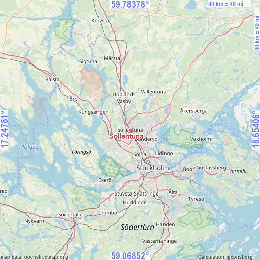
Sollentuna GPS coordinates[2]
59° 25' 40.944" North, 17° 57' 3.348" East
| Map corner | latitude | longitude |
|---|---|---|
| Upper-left | 59.78378°, | 17.24781° |
| Center: | 59.42804°, | 17.95093° |
| Lower-right: | 59.06852°, | 18.65406° |
| Map W x H: | 79.5×79.5 km | = 49.4×49.4mi |
| max Lat: | 67.85572° ⇑35.2% North |
| Sollentuna: | 59.42804° |
| min Lat: | ⇓64.8% South 55.34337° |
| min Long | Sollentuna | max Long |
| 11.1712° | 17.95093° | 24.13676° |
| W 85.4%⇐ | ⇒14.6% E |
Elevation
Elevation of Sollentuna is 25 m = 82 ft, and this is 57.6 m = 189 ft below average elevation for this country.
| Max E: |
663 m = 2175 ft | 70% |
| Avg. | 82.6 m = 271 ft | |
| Sollentuna | 25 m = 82 ft | |
Min E: |
-1 m = -3 ft | 30% |
See also: Sollentuna elevation on elevation.city.
Geographical zone
Sollentuna is located in North temperate zone (between Tropic of Cancer and the Arctic Circle). Distance of this North polar circle is 793.4 km =493 mi to North.| Distance of | km | miles | from Sollentuna |
|---|---|---|---|
| North Pole | 3399.3 | 2112.2 | to North |
| Arctic Circle | 793.4 | 493 | to North |
| Tropic Cancer | 4001.9 | 2486.7 | to South |
| Equator | 6607.8 | 4105.9 | to South |


Nearby cities:
15 places around Sollentuna: (largest is in red/bold)
• Akalla
2.6 km =1.6 mi,  234°
234°
• Alvik
10.8 km =6.7 mi,  170°
170°
• Bergshamra
7.1 km =4.4 mi,  138°
138°
• Bromma
9.8 km =6.1 mi,  183°
183°
• Djursholm
6.8 km =4.2 mi,  118°
118°
• Enebyberg
5.6 km =3.5 mi,  84°
84°
• Jakobsberg
6.6 km =4.1 mi,  264°
264°
• Kista
2.8 km =1.7 mi,  187°
187°
• Råsunda
7.4 km =4.6 mi,  159°
159°
• Solna
8.1 km =5 mi, 159°
• Sundbyberg
7.5 km =4.7 mi, 171°
• Tensta
4.7 km =2.9 mi,  216°
216°
• Täby
6.9 km =4.3 mi, 75°
• Upplands Väsby
10.3 km =6.4 mi,  347°
347°
• Vasastan
10.7 km =6.6 mi,  148°
148°
Sources, notices
• [Note1] Compared only with cities in Sweden existing in our database
• [Src1] Map data: © OpenStreetMap contributors (CC-BY-SA)
• [Src2] Other city data from geonames.org with taken over terms of usage.
• [Src3] Geographical zone / Annual Mean Temperature by Robert A. Rohde @ Wikipedia
