Sandarne geodata
Sandarne (Gävleborg) is a populated place; located in Sweden in Europe/Stockholm (GMT+2) time zone. With population of 1,681 people, there are 602 cities with bigger population in this country. Compared to other cities in Sweden, 83.6% of cities are located further ↓South; 76% of cities are located further ←West and 99.8% of cities have higher elevation than Sandarne. Note1


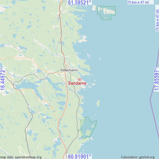
Sandarne GPS coordinates[2]
61° 15' 32.148" North, 17° 9' 10.224" East
| Map corner | latitude | longitude |
|---|---|---|
| Upper-left | 61.59521°, | 16.44972° |
| Center: | 61.25893°, | 17.15284° |
| Lower-right: | 60.91901°, | 17.85597° |
| Map W x H: | 75.2×75.2 km | = 46.7×46.7mi |
| max Lat: | 67.85572° ⇑16.4% North |
| Sandarne: | 61.25893° |
| min Lat: | ⇓83.6% South 55.34337° |
| min Long | Sandarne | max Long |
| 11.1712° | 17.15284° | 24.13676° |
| W 76%⇐ | ⇒24% E |
Elevation
Elevation of Sandarne is 1 m = 3 ft, and this is 81.6 m = 268 ft below average elevation for this country.
| Max E: |
663 m = 2175 ft | 99.8% |
| Avg. | 82.6 m = 271 ft | |
| Sandarne | 1 m = 3 ft | |
Min E: |
-1 m = -3 ft | 0.2% |
See also: Sweden elevation on elevation.city.
Geographical zone
Sandarne is located in North temperate zone (between Tropic of Cancer and the Arctic Circle). Distance of this North polar circle is 589.8 km =366.5 mi to North.| Distance of | km | miles | from Sandarne |
|---|---|---|---|
| North Pole | 3195.7 | 1985.7 | to North |
| Arctic Circle | 589.8 | 366.5 | to North |
| Tropic Cancer | 4205.4 | 2613.1 | to South |
| Equator | 6811.4 | 4232.4 | to South |


Nearby cities:
15 places around Sandarne: (largest is in red/bold)
• Bergby
37.1 km =23.1 mi,  189°
189°
• Bergvik
17.4 km =10.8 mi,  268°
268°
• Bollnäs
41.7 km =25.9 mi,  283°
283°
• Enånger
32.8 km =20.4 mi,  346°
346°
• Hamrångefjärden
40.2 km =25 mi, 186°
• Iggesund
42.8 km =26.6 mi, 354°
• Kilafors
31.5 km =19.6 mi,  264°
264°
• Ljusne
5.4 km =3.4 mi, 194°
• Mohed
18.6 km =11.6 mi, 283°
• Njutånger
39.7 km =24.7 mi, 352°
• Norrsundet
34.4 km =21.4 mi,  181°
181°
• Ockelbo
47.1 km =29.3 mi,  209°
209°
• Söderala
10.3 km =6.4 mi,  285°
285°
• Söderhamn
7.1 km =4.4 mi,  314°
314°
• Åbyggeby
46.7 km =29 mi,  215°
215°
Sources, notices
• [Note1] Compared only with cities in Sweden existing in our database
• [Src1] Map data: © OpenStreetMap contributors (CC-BY-SA)
• [Src2] Other city data from geonames.org with taken over terms of usage.
• [Src3] Geographical zone / Annual Mean Temperature by Robert A. Rohde @ Wikipedia
