Iggesund geodata
Iggesund (Gävleborg) is a populated place; located in Sweden in Europe/Stockholm (GMT+2) time zone. With population of 3,419 people, there are 367 cities with bigger population in this country. Compared to other cities in Sweden, 84.4% of cities are located further ↓South; 75% of cities are located further ←West and 65.3% of cities have higher elevation than Iggesund. Note1
Administrative division(s):
- Level 1: Gävleborg
- Level 2: Hudiksvalls Kommun
- Level 3: Enånger-Njutånger
- Level 4: Njutånger socken


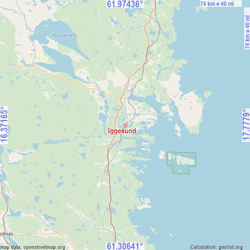
Iggesund GPS coordinates[2]
61° 38' 31.884" North, 17° 4' 29.172" East
| Map corner | latitude | longitude |
|---|---|---|
| Upper-left | 61.97436°, | 16.37165° |
| Center: | 61.64219°, | 17.07477° |
| Lower-right: | 61.30641°, | 17.7779° |
| Map W x H: | 74.3×74.3 km | = 46.2×46.2mi |
| max Lat: | 67.85572° ⇑15.6% North |
| Iggesund: | 61.64219° |
| min Lat: | ⇓84.4% South 55.34337° |
| min Long | Iggesund | max Long |
| 11.1712° | 17.07477° | 24.13676° |
| W 75%⇐ | ⇒25% E |
Elevation
Elevation of Iggesund is 30 m = 98 ft, and this is 52.6 m = 173 ft below average elevation for this country.
| Max E: |
663 m = 2175 ft | 65.3% |
| Avg. | 82.6 m = 271 ft | |
| Iggesund | 30 m = 98 ft | |
Min E: |
-1 m = -3 ft | 34.7% |
See also: Sweden elevation on elevation.city.
Geographical zone
Iggesund is located in North temperate zone (between Tropic of Cancer and the Arctic Circle). Distance of this North polar circle is 547.2 km =340 mi to North.| Distance of | km | miles | from Iggesund |
|---|---|---|---|
| North Pole | 3153.1 | 1959.2 | to North |
| Arctic Circle | 547.2 | 340 | to North |
| Tropic Cancer | 4248.1 | 2639.6 | to South |
| Equator | 6854 | 4258.9 | to South |


Nearby cities:
15 places around Iggesund: (largest is in red/bold)
• Arbrå
41.5 km =25.8 mi,  241°
241°
• Bergsjö
37.8 km =23.5 mi,  359°
359°
• Bergvik
45.2 km =28.1 mi,  196°
196°
• Delsbo
32.6 km =20.3 mi,  302°
302°
• Enånger
11.3 km =7 mi, 197°
• Friggesund
39.5 km =24.5 mi,  315°
315°
• Harmånger
32.6 km =20.3 mi,  13°
13°
• Hudiksvall
9.6 km =6 mi, 9°
• Mohed
40.7 km =25.3 mi, 199°
• Njutånger
3.5 km =2.2 mi, 197°
• Näsviken
17.7 km =11 mi, 321°
• Sandarne
42.8 km =26.6 mi,  174°
174°
• Söderala
40.3 km =25 mi,  188°
188°
• Söderhamn
37.6 km =23.4 mi,  181°
181°
• Sörforsa
11.2 km =7 mi,  334°
334°
Sources, notices
• [Note1] Compared only with cities in Sweden existing in our database
• [Src1] Map data: © OpenStreetMap contributors (CC-BY-SA)
• [Src2] Other city data from geonames.org with taken over terms of usage.
• [Src3] Geographical zone / Annual Mean Temperature by Robert A. Rohde @ Wikipedia
