Bollnäs geodata
Bollnäs (Gävleborg) is a seat of a second-order administrative division; located in Sweden in Europe/Stockholm (GMT+2) time zone. With population of 13,716 people, there are 112 cities with bigger population in this country. Compared to other cities in Sweden, 84% of cities are located further ↓South; 66.9% of cities are located further ←West and 58.3% of cities have higher elevation than Bollnäs. Note1


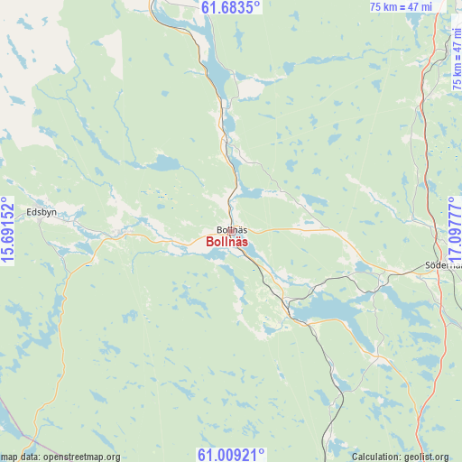
Bollnäs GPS coordinates[2]
61° 20' 53.412" North, 16° 23' 40.704" East
| Map corner | latitude | longitude |
|---|---|---|
| Upper-left | 61.6835°, | 15.69152° |
| Center: | 61.34817°, | 16.39464° |
| Lower-right: | 61.00921°, | 17.09777° |
| Map W x H: | 75×75 km | = 46.6×46.6mi |
| max Lat: | 67.85572° ⇑16% North |
| Bollnäs: | 61.34817° |
| min Lat: | ⇓84% South 55.34337° |
| min Long | Bollnäs | max Long |
| 11.1712° | 16.39464° | 24.13676° |
| W 66.9%⇐ | ⇒33.1% E |
Elevation
Elevation of Bollnäs is 38 m = 125 ft, and this is 44.6 m = 146 ft below average elevation for this country.
| Max E: |
663 m = 2175 ft | 58.3% |
| Avg. | 82.6 m = 271 ft | |
| Bollnäs | 38 m = 125 ft | |
Min E: |
-1 m = -3 ft | 41.7% |
See also: Sweden elevation on elevation.city.
Geographical zone
Bollnäs is located in North temperate zone (between Tropic of Cancer and the Arctic Circle). Distance of this North polar circle is 579.9 km =360.3 mi to North.| Distance of | km | miles | from Bollnäs |
|---|---|---|---|
| North Pole | 3185.8 | 1979.6 | to North |
| Arctic Circle | 579.9 | 360.3 | to North |
| Tropic Cancer | 4215.4 | 2619.3 | to South |
| Equator | 6821.3 | 4238.6 | to South |


Nearby cities:
15 places around Bollnäs: (largest is in red/bold)
• Alfta
17 km =10.6 mi,  269°
269°
• Arbrå
13.2 km =8.2 mi,  357°
357°
• Bergvik
25.4 km =15.8 mi,  114°
114°
• Edsbyn
30.9 km =19.2 mi,  275°
275°
• Enånger
39.4 km =24.5 mi,  56°
56°
• Iggesund
48.7 km =30.3 mi,  47°
47°
• Järvsö
42.7 km =26.5 mi,  343°
343°
• Kilafors
15.7 km =9.8 mi,  144°
144°
• Ljusne
42 km =26.1 mi, 111°
• Mohed
23.1 km =14.4 mi,  104°
104°
• Njutånger
45.8 km =28.5 mi, 50°
• Sandarne
41.7 km =25.9 mi, 103°
• Söderala
31.4 km =19.5 mi, 103°
• Söderhamn
35.8 km =22.2 mi, 97°
• Åbyggeby
49.9 km =31 mi,  164°
164°
Sources, notices
• [Note1] Compared only with cities in Sweden existing in our database
• [Src1] Map data: © OpenStreetMap contributors (CC-BY-SA)
• [Src2] Other city data from geonames.org with taken over terms of usage.
• [Src3] Geographical zone / Annual Mean Temperature by Robert A. Rohde @ Wikipedia
