Pålsboda geodata
Pålsboda (Örebro) is a populated place; located in Sweden in Europe/Stockholm (GMT+2) time zone. With population of 1,610 people, there are 617 cities with bigger population in this country. Compared to other cities in Sweden, 54.8% of cities are located further ↓South; 53.7% of cities are located further ←West and 68.5% of cities have lower elevation than Pålsboda. Note1
Administrative division(s):
- Level 1: Örebro
- Level 2: Hallsbergs Kommun
- Level 3: Sköllersta
- Level 4: Sköllersta socken


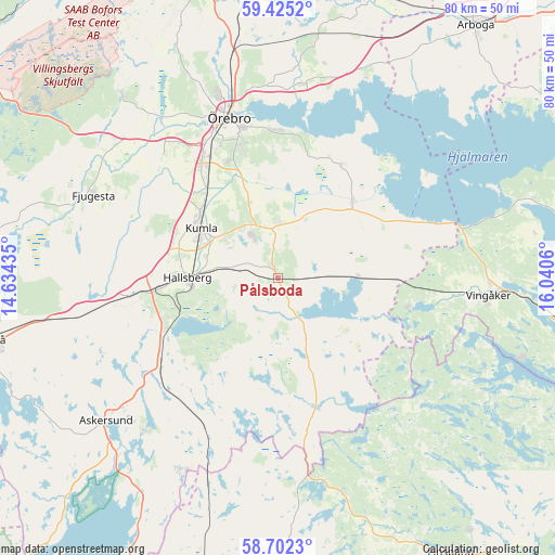
Pålsboda GPS coordinates[2]
59° 3' 56.34" North, 15° 20' 14.892" East
| Map corner | latitude | longitude |
|---|---|---|
| Upper-left | 59.4252°, | 14.63435° |
| Center: | 59.06565°, | 15.33747° |
| Lower-right: | 58.7023°, | 16.0406° |
| Map W x H: | 80.4×80.4 km | = 50×50mi |
| max Lat: | 67.85572° ⇑45.2% North |
| Pålsboda: | 59.06565° |
| min Lat: | ⇓54.8% South 55.34337° |
| min Long | Pålsboda | max Long |
| 11.1712° | 15.33747° | 24.13676° |
| W 53.7%⇐ | ⇒46.3% E |
Elevation
Elevation of Pålsboda is 94 m = 308 ft, and this is 11.4 m = 37 ft above average elevation for this country.
| Max E: |
663 m = 2175 ft | 31.5% |
| Pålsboda | 94 m 308 ft | |
| Avg. | 82.6 m = 271 ft | |
Min E: |
-1 m = -3 ft | 68.5% |
See also: Sweden elevation on elevation.city.
Geographical zone
Pålsboda is located in North temperate zone (between Tropic of Cancer and the Arctic Circle). Distance of this North polar circle is 833.7 km =518 mi to North.| Distance of | km | miles | from Pålsboda |
|---|---|---|---|
| North Pole | 3439.6 | 2137.3 | to North |
| Arctic Circle | 833.7 | 518 | to North |
| Tropic Cancer | 3961.6 | 2461.6 | to South |
| Equator | 6567.5 | 4080.9 | to South |


Nearby cities:
15 places around Pålsboda: (largest is in red/bold)
• Ekeby-Almby
21.6 km =13.4 mi,  358°
358°
• Hallsberg
13 km =8.1 mi,  269°
269°
• Hällabrottet
9.7 km =6 mi,  305°
305°
• Högsjö
19.4 km =12.1 mi,  102°
102°
• Kumla
13.1 km =8.1 mi,  301°
301°
• Mellösa
17.6 km =10.9 mi,  31°
31°
• Mosås
18.9 km =11.7 mi,  322°
322°
• Norra Bro
17.5 km =10.9 mi,  343°
343°
• Odensbacken
15.8 km =9.8 mi,  44°
44°
• Sköllersta
8 km =5 mi,  0°
0°
• Stora Mellösa
19.2 km =11.9 mi, 28°
• Velanda
21.5 km =13.4 mi, 314°
• Åbytorp
16.5 km =10.3 mi,  293°
293°
• Åsbro
18 km =11.2 mi,  246°
246°
• Östansjö
20.3 km =12.6 mi, 265°
Sources, notices
• [Note1] Compared only with cities in Sweden existing in our database
• [Src1] Map data: © OpenStreetMap contributors (CC-BY-SA)
• [Src2] Other city data from geonames.org with taken over terms of usage.
• [Src3] Geographical zone / Annual Mean Temperature by Robert A. Rohde @ Wikipedia
