Odensbacken geodata
Odensbacken (Örebro) is a populated place; located in Sweden in Europe/Stockholm (GMT+2) time zone. With population of 1,378 people, there are 691 cities with bigger population in this country. Compared to other cities in Sweden, 56.2% of cities are located further ↓South; 55.9% of cities are located further ←West and 68.9% of cities have higher elevation than Odensbacken. Note1


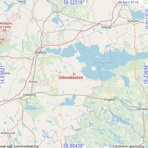
Odensbacken GPS coordinates[2]
59° 10' 0.012" North, 15° 31' 59.988" East
| Map corner | latitude | longitude |
|---|---|---|
| Upper-left | 59.52516°, | 14.83021° |
| Center: | 59.16667°, | 15.53333° |
| Lower-right: | 58.80439°, | 16.23646° |
| Map W x H: | 80.1×80.1 km | = 49.8×49.8mi |
| max Lat: | 67.85572° ⇑43.8% North |
| Odensbacken: | 59.16667° |
| min Lat: | ⇓56.2% South 55.34337° |
| min Long | Odensbacken | max Long |
| 11.1712° | 15.53333° | 24.13676° |
| W 55.9%⇐ | ⇒44.1% E |
Elevation
Elevation of Odensbacken is 26 m = 85 ft, and this is 56.6 m = 186 ft below average elevation for this country.
| Max E: |
663 m = 2175 ft | 68.9% |
| Avg. | 82.6 m = 271 ft | |
| Odensbacken | 26 m = 85 ft | |
Min E: |
-1 m = -3 ft | 31.1% |
See also: Sweden elevation on elevation.city.
Geographical zone
Odensbacken is located in North temperate zone (between Tropic of Cancer and the Arctic Circle). Distance of this North polar circle is 822.5 km =511.1 mi to North.| Distance of | km | miles | from Odensbacken |
|---|---|---|---|
| North Pole | 3428.3 | 2130.2 | to North |
| Arctic Circle | 822.5 | 511.1 | to North |
| Tropic Cancer | 3972.8 | 2468.6 | to South |
| Equator | 6578.7 | 4087.8 | to South |


Nearby cities:
15 places around Odensbacken: (largest is in red/bold)
• Ekeby-Almby
15.5 km =9.6 mi,  311°
311°
• Glanshammar
18.3 km =11.4 mi,  335°
335°
• Hallsberg
26.7 km =16.6 mi,  244°
244°
• Hällabrottet
19.8 km =12.3 mi,  253°
253°
• Högsjö
17.4 km =10.8 mi,  153°
153°
• Kumla
22.7 km =14.1 mi,  258°
258°
• Mellösa
4.2 km =2.6 mi,  332°
332°
• Mosås
23.1 km =14.4 mi,  279°
279°
• Norra Bro
17.1 km =10.6 mi,  289°
289°
• Pålsboda
15.8 km =9.8 mi,  224°
224°
• Sköllersta
11.5 km =7.1 mi, 253°
• Stora Mellösa
5.9 km =3.7 mi, 341°
• Vingåker
23.8 km =14.8 mi,  125°
125°
• Åbytorp
26.6 km =16.5 mi, 260°
• Örebro
22.1 km =13.7 mi,  302°
302°
Sources, notices
• [Note1] Compared only with cities in Sweden existing in our database
• [Src1] Map data: © OpenStreetMap contributors (CC-BY-SA)
• [Src2] Other city data from geonames.org with taken over terms of usage.
• [Src3] Geographical zone / Annual Mean Temperature by Robert A. Rohde @ Wikipedia
