Harplinge geodata
Harplinge (Halland) is a populated place; located in Sweden in Europe/Stockholm (GMT+2) time zone. With population of 1,498 people, there are 657 cities with bigger population in this country. Compared to other cities in Sweden, 80.5% of cities are located further ↑North; 85.8% of cities are located further →East and 53.8% of cities have higher elevation than Harplinge. Note1


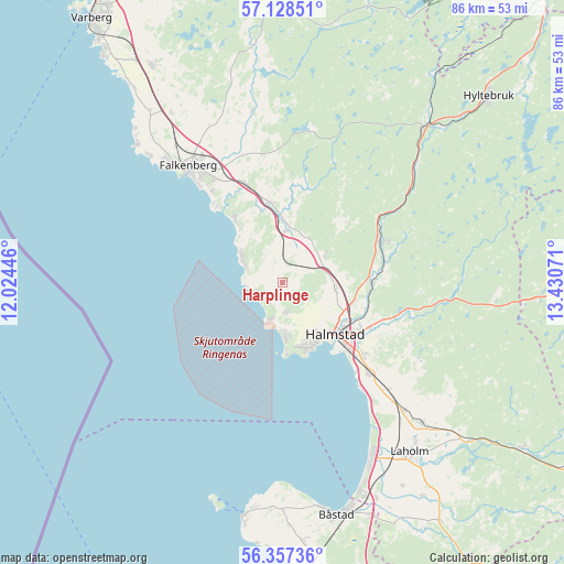
Harplinge GPS coordinates[2]
56° 44' 41.676" North, 12° 43' 39.288" East
| Map corner | latitude | longitude |
|---|---|---|
| Upper-left | 57.12851°, | 12.02446° |
| Center: | 56.74491°, | 12.72758° |
| Lower-right: | 56.35736°, | 13.43071° |
| Map W x H: | 85.7×85.7 km | = 53.3×53.3mi |
| max Lat: | 67.85572° ⇑80.5% North |
| Harplinge: | 56.74491° |
| min Lat: | ⇓19.5% South 55.34337° |
| min Long | Harplinge | max Long |
| 11.1712° | 12.72758° | 24.13676° |
| W 14.2%⇐ | ⇒85.8% E |
Elevation
Elevation of Harplinge is 44 m = 144 ft, and this is 38.6 m = 127 ft below average elevation for this country.
| Max E: |
663 m = 2175 ft | 53.8% |
| Avg. | 82.6 m = 271 ft | |
| Harplinge | 44 m = 144 ft | |
Min E: |
-1 m = -3 ft | 46.2% |
See also: Sweden elevation on elevation.city.
Geographical zone
Harplinge is located in North temperate zone (between Tropic of Cancer and the Arctic Circle). Distance of this North polar circle is 1091.7 km =678.4 mi to North.| Distance of | km | miles | from Harplinge |
|---|---|---|---|
| North Pole | 3697.6 | 2297.6 | to North |
| Arctic Circle | 1091.7 | 678.4 | to North |
| Tropic Cancer | 3703.5 | 2301.2 | to South |
| Equator | 6309.4 | 3920.5 | to South |


Nearby cities:
15 places around Harplinge: (largest is in red/bold)
• Frösakull
6.9 km =4.3 mi,  177°
177°
• Fyllinge
15.6 km =9.7 mi,  132°
132°
• Getinge
8 km =5 mi,  2°
2°
• Gullbrandstorp
5 km =3.1 mi, 175°
• Halmstad
11.1 km =6.9 mi, 134°
• Haverdal
4.2 km =2.6 mi,  233°
233°
• Holm
7.8 km =4.8 mi,  94°
94°
• Kvibille
7.7 km =4.8 mi,  56°
56°
• Mjällby
7.3 km =4.5 mi,  160°
160°
• Oskarström
15.8 km =9.8 mi,  67°
67°
• Skrea
18.2 km =11.3 mi,  327°
327°
• Slöinge
12 km =7.5 mi,  347°
347°
• Steninge
6.5 km =4 mi,  294°
294°
• Villshärad
5.9 km =3.7 mi,  199°
199°
• Åled
12.6 km =7.8 mi, 87°
Sources, notices
• [Note1] Compared only with cities in Sweden existing in our database
• [Src1] Map data: © OpenStreetMap contributors (CC-BY-SA)
• [Src2] Other city data from geonames.org with taken over terms of usage.
• [Src3] Geographical zone / Annual Mean Temperature by Robert A. Rohde @ Wikipedia
