Halmstad geodata
Halmstad (Halland) is a seat of a first-order administrative division; located in Sweden in Europe/Stockholm (GMT+2) time zone. With population of 66,124 people, there are 22 cities with bigger population in this country. Compared to other cities in Sweden, 81.6% of cities are located further ↑North; 83.1% of cities are located further →East and 87.5% of cities have higher elevation than Halmstad. Note1


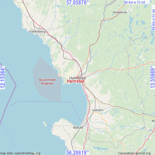
Halmstad GPS coordinates[2]
56° 40' 28.056" North, 12° 51' 24.336" East
| Map corner | latitude | longitude |
|---|---|---|
| Upper-left | 57.05878°, | 12.15364° |
| Center: | 56.67446°, | 12.85676° |
| Lower-right: | 56.28618°, | 13.55989° |
| Map W x H: | 85.9×85.9 km | = 53.4×53.4mi |
| max Lat: | 67.85572° ⇑81.6% North |
| Halmstad: | 56.67446° |
| min Lat: | ⇓18.4% South 55.34337° |
| min Long | Halmstad | max Long |
| 11.1712° | 12.85676° | 24.13676° |
| W 16.9%⇐ | ⇒83.1% E |
Elevation
Elevation of Halmstad is 11 m = 36 ft, and this is 71.6 m = 235 ft below average elevation for this country.
| Max E: |
663 m = 2175 ft | 87.5% |
| Avg. | 82.6 m = 271 ft | |
| Halmstad | 11 m = 36 ft | |
Min E: |
-1 m = -3 ft | 12.5% |
See also: Halmstad elevation on elevation.city.
Geographical zone
Halmstad is located in North temperate zone (between Tropic of Cancer and the Arctic Circle). Distance of this North polar circle is 1099.6 km =683.3 mi to North.| Distance of | km | miles | from Halmstad |
|---|---|---|---|
| North Pole | 3705.5 | 2302.5 | to North |
| Arctic Circle | 1099.6 | 683.3 | to North |
| Tropic Cancer | 3695.7 | 2296.4 | to South |
| Equator | 6301.6 | 3915.6 | to South |


Nearby cities:
15 places around Halmstad: (largest is in red/bold)
• Eldsberga
12.1 km =7.5 mi,  133°
133°
• Frösakull
7.6 km =4.7 mi,  277°
277°
• Fyllinge
4.6 km =2.9 mi, 126°
• Genevad
15.9 km =9.9 mi,  137°
137°
• Gullbrandstorp
8.1 km =5 mi,  290°
290°
• Gullbranna
10.8 km =6.7 mi,  148°
148°
• Harplinge
11.1 km =6.9 mi,  314°
314°
• Haverdal
12.5 km =7.8 mi,  295°
295°
• Holm
7.2 km =4.5 mi,  358°
358°
• Kvibille
12.2 km =7.6 mi,  353°
353°
• Mjällby
5.6 km =3.5 mi, 280°
• Oskarström
15.5 km =9.6 mi,  25°
25°
• Trönninge
7.9 km =4.9 mi, 143°
• Villshärad
10.1 km =6.3 mi, 282°
• Åled
9.6 km =6 mi, 29°
Sources, notices
• [Note1] Compared only with cities in Sweden existing in our database
• [Src1] Map data: © OpenStreetMap contributors (CC-BY-SA)
• [Src2] Other city data from geonames.org with taken over terms of usage.
• [Src3] Geographical zone / Annual Mean Temperature by Robert A. Rohde @ Wikipedia
