Frösakull geodata
Frösakull (Halland) is a populated place; located in Sweden in Europe/Stockholm (GMT+2) time zone. With population of 2,296 people, there are 477 cities with bigger population in this country. Compared to other cities in Sweden, 81.4% of cities are located further ↑North; 85.7% of cities are located further →East and 66.2% of cities have higher elevation than Frösakull. Note1


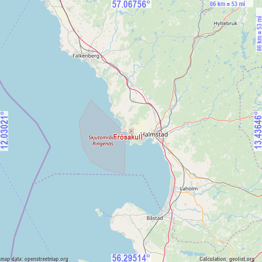
Frösakull GPS coordinates[2]
56° 40' 59.988" North, 12° 43' 59.988" East
| Map corner | latitude | longitude |
|---|---|---|
| Upper-left | 57.06756°, | 12.03021° |
| Center: | 56.68333°, | 12.73333° |
| Lower-right: | 56.29514°, | 13.43646° |
| Map W x H: | 85.9×85.9 km | = 53.4×53.4mi |
| max Lat: | 67.85572° ⇑81.4% North |
| Frösakull: | 56.68333° |
| min Lat: | ⇓18.6% South 55.34337° |
| min Long | Frösakull | max Long |
| 11.1712° | 12.73333° | 24.13676° |
| W 14.3%⇐ | ⇒85.7% E |
Elevation
Elevation of Frösakull is 28 m = 92 ft, and this is 54.6 m = 179 ft below average elevation for this country.
| Max E: |
663 m = 2175 ft | 66.2% |
| Avg. | 82.6 m = 271 ft | |
| Frösakull | 28 m = 92 ft | |
Min E: |
-1 m = -3 ft | 33.8% |
See also: Sweden elevation on elevation.city.
Geographical zone
Frösakull is located in North temperate zone (between Tropic of Cancer and the Arctic Circle). Distance of this North polar circle is 1098.6 km =682.6 mi to North.| Distance of | km | miles | from Frösakull |
|---|---|---|---|
| North Pole | 3704.5 | 2301.9 | to North |
| Arctic Circle | 1098.6 | 682.6 | to North |
| Tropic Cancer | 3696.7 | 2297 | to South |
| Equator | 6302.6 | 3916.3 | to South |


Nearby cities:
15 places around Frösakull: (largest is in red/bold)
• Eldsberga
18.8 km =11.7 mi,  119°
119°
• Fyllinge
11.8 km =7.3 mi,  108°
108°
• Getinge
14.8 km =9.2 mi,  0°
0°
• Gullbrandstorp
1.9 km =1.2 mi, 0°
• Gullbranna
16.7 km =10.4 mi,  127°
127°
• Halmstad
7.6 km =4.7 mi,  97°
97°
• Harplinge
6.9 km =4.3 mi,  357°
357°
• Haverdal
5.7 km =3.5 mi,  319°
319°
• Holm
9.7 km =6 mi,  49°
49°
• Kvibille
12.7 km =7.9 mi,  28°
28°
• Mjällby
2 km =1.2 mi,  90°
90°
• Steninge
11.4 km =7.1 mi,  326°
326°
• Trönninge
14.3 km =8.9 mi, 121°
• Villshärad
2.6 km =1.6 mi,  298°
298°
• Åled
14.3 km =8.9 mi,  58°
58°
Sources, notices
• [Note1] Compared only with cities in Sweden existing in our database
• [Src1] Map data: © OpenStreetMap contributors (CC-BY-SA)
• [Src2] Other city data from geonames.org with taken over terms of usage.
• [Src3] Geographical zone / Annual Mean Temperature by Robert A. Rohde @ Wikipedia
