Gagnef geodata
Gagnef (Dalarna) is a seat of a second-order administrative division; located in Sweden in Europe/Stockholm (GMT+2) time zone. With population of 1,199 people, there are 742 cities with bigger population in this country. Compared to other cities in Sweden, 79.5% of cities are located further ↓South; 50.5% of cities are located further ←West and 85.8% of cities have lower elevation than Gagnef. Note1


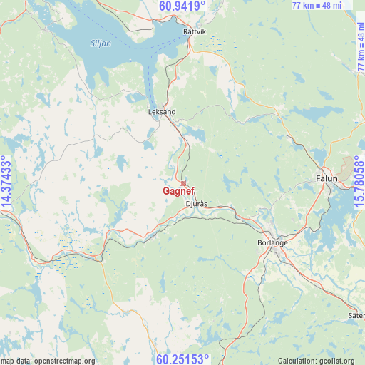
Gagnef GPS coordinates[2]
60° 35' 54.816" North, 15° 4' 38.82" East
| Map corner | latitude | longitude |
|---|---|---|
| Upper-left | 60.9419°, | 14.37433° |
| Center: | 60.59856°, | 15.07745° |
| Lower-right: | 60.25153°, | 15.78058° |
| Map W x H: | 76.8×76.8 km | = 47.7×47.7mi |
| max Lat: | 67.85572° ⇑20.5% North |
| Gagnef: | 60.59856° |
| min Lat: | ⇓79.5% South 55.34337° |
| min Long | Gagnef | max Long |
| 11.1712° | 15.07745° | 24.13676° |
| W 50.5%⇐ | ⇒49.5% E |
Elevation
Elevation of Gagnef is 172 m = 564 ft, and this is 89.4 m = 293 ft above average elevation for this country.
| Max E: |
663 m = 2175 ft | 14.2% |
| Gagnef | 172 m 564 ft | |
| Avg. | 82.6 m = 271 ft | |
Min E: |
-1 m = -3 ft | 85.8% |
See also: Sweden elevation on elevation.city.
Geographical zone
Gagnef is located in North temperate zone (between Tropic of Cancer and the Arctic Circle). Distance of this North polar circle is 663.2 km =412.1 mi to North.| Distance of | km | miles | from Gagnef |
|---|---|---|---|
| North Pole | 3269.1 | 2031.3 | to North |
| Arctic Circle | 663.2 | 412.1 | to North |
| Tropic Cancer | 4132 | 2567.5 | to South |
| Equator | 6737.9 | 4186.7 | to South |


Nearby cities:
15 places around Gagnef: (largest is in red/bold)
• Björbo
25.1 km =15.6 mi,  231°
231°
• Borlänge
23.3 km =14.5 mi,  122°
122°
• Bäsna
9.9 km =6.2 mi,  137°
137°
• Djurmo
7.9 km =4.9 mi,  132°
132°
• Djurås
5.2 km =3.2 mi, 144°
• Floda
18.7 km =11.6 mi,  236°
236°
• Grycksbo
24.3 km =15.1 mi,  66°
66°
• Häradsbygden
11.5 km =7.1 mi,  347°
347°
• Insjön
8.8 km =5.5 mi,  6°
6°
• Leksand
15.2 km =9.4 mi,  343°
343°
• Mockfjärd
12.5 km =7.8 mi,  208°
208°
• Siljansnäs
24 km =14.9 mi,  328°
328°
• Smedby
11.4 km =7.1 mi, 352°
• Sågmyra
17.3 km =10.7 mi,  40°
40°
• Tällberg
24.6 km =15.3 mi, 350°
Sources, notices
• [Note1] Compared only with cities in Sweden existing in our database
• [Src1] Map data: © OpenStreetMap contributors (CC-BY-SA)
• [Src2] Other city data from geonames.org with taken over terms of usage.
• [Src3] Geographical zone / Annual Mean Temperature by Robert A. Rohde @ Wikipedia
