Älvdalen geodata
Älvdalen (Dalarna) is a seat of a second-order administrative division; located in Sweden in Europe/Stockholm (GMT+2) time zone. With population of 1,863 people, there are 553 cities with bigger population in this country. Compared to other cities in Sweden, 83.3% of cities are located further ↓South; 64% of cities are located further →East and 94.7% of cities have lower elevation than Älvdalen. Note1


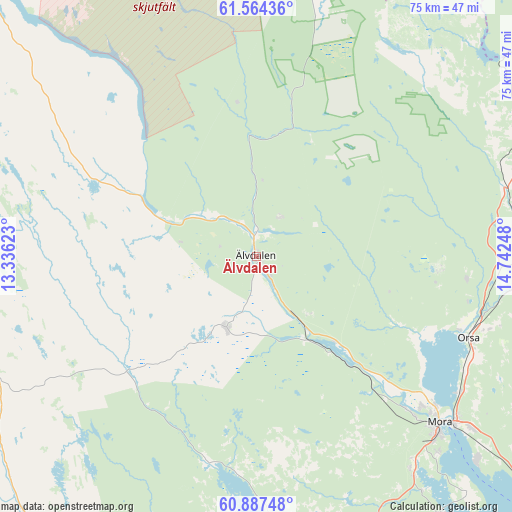
Älvdalen GPS coordinates[2]
61° 13' 39.864" North, 14° 2' 21.66" East
| Map corner | latitude | longitude |
|---|---|---|
| Upper-left | 61.56436°, | 13.33623° |
| Center: | 61.22774°, | 14.03935° |
| Lower-right: | 60.88748°, | 14.74248° |
| Map W x H: | 75.3×75.3 km | = 46.8×46.8mi |
| max Lat: | 67.85572° ⇑16.7% North |
| Älvdalen: | 61.22774° |
| min Lat: | ⇓83.3% South 55.34337° |
| min Long | Älvdalen | max Long |
| 11.1712° | 14.03935° | 24.13676° |
| W 36%⇐ | ⇒64% E |
Elevation
Elevation of Älvdalen is 253 m = 830 ft, and this is 170.4 m = 559 ft above average elevation for this country.
| Max E: |
663 m = 2175 ft | 5.3% |
| Älvdalen | 253 m 830 ft | |
| Avg. | 82.6 m = 271 ft | |
Min E: |
-1 m = -3 ft | 94.7% |
See also: Sweden elevation on elevation.city.
Geographical zone
Älvdalen is located in North temperate zone (between Tropic of Cancer and the Arctic Circle). Distance of this North polar circle is 593.3 km =368.7 mi to North.| Distance of | km | miles | from Älvdalen |
|---|---|---|---|
| North Pole | 3199.2 | 1987.9 | to North |
| Arctic Circle | 593.3 | 368.7 | to North |
| Tropic Cancer | 4202 | 2611 | to South |
| Equator | 6807.9 | 4230.2 | to South |


Nearby cities:
15 places around Älvdalen: (largest is in red/bold)
• Backa
66.4 km =41.3 mi,  120°
120°
• Färnäs
40.7 km =25.3 mi,  128°
128°
• Malung
63 km =39.1 mi,  196°
196°
• Malungsfors
61 km =37.9 mi,  205°
205°
• Mora
36.5 km =22.7 mi, 132°
• Nusnäs
43.1 km =26.8 mi, 132°
• Orsa
33.1 km =20.6 mi,  111°
111°
• Rot
2.5 km =1.6 mi,  352°
352°
• Selja
32.8 km =20.4 mi,  135°
135°
• Siljansnäs
66 km =41 mi, 138°
• Sollerön
46.5 km =28.9 mi, 138°
• Sälen
42.3 km =26.3 mi,  258°
258°
• Vikarbyn
62.9 km =39.1 mi, 123°
• Våmhus
26.4 km =16.4 mi, 118°
• Östnor
32.2 km =20 mi, 132°
Sources, notices
• [Note1] Compared only with cities in Sweden existing in our database
• [Src1] Map data: © OpenStreetMap contributors (CC-BY-SA)
• [Src2] Other city data from geonames.org with taken over terms of usage.
• [Src3] Geographical zone / Annual Mean Temperature by Robert A. Rohde @ Wikipedia
