Bergnäset geodata
Bergnäset (Norrbotten) is a populated place; located in Sweden in Europe/Stockholm (GMT+2) time zone. With population of 3,604 people, there are 356 cities with bigger population in this country. Compared to other cities in Sweden, 97.2% of cities are located further ↓South; 98.7% of cities are located further ←West and 99.8% of cities have higher elevation than Bergnäset. Note1


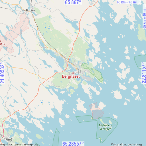
Bergnäset GPS coordinates[2]
65° 34' 40.476" North, 22° 6' 30.384" East
| Map corner | latitude | longitude |
|---|---|---|
| Upper-left | 65.867°, | 21.40532° |
| Center: | 65.57791°, | 22.10844° |
| Lower-right: | 65.28557°, | 22.81157° |
| Map W x H: | 64.6×64.6 km | = 40.1×40.1mi |
| max Lat: | 67.85572° ⇑2.8% North |
| Bergnäset: | 65.57791° |
| min Lat: | ⇓97.2% South 55.34337° |
| min Long | Bergnäset | max Long |
| 11.1712° | 22.10844° | 24.13676° |
| W 98.7%⇐ | ⇒1.3% E |
Elevation
Elevation of Bergnäset is 1 m = 3 ft, and this is 81.6 m = 268 ft below average elevation for this country.
| Max E: |
663 m = 2175 ft | 99.8% |
| Avg. | 82.6 m = 271 ft | |
| Bergnäset | 1 m = 3 ft | |
Min E: |
-1 m = -3 ft | 0.2% |
See also: Sweden elevation on elevation.city.
Geographical zone
Bergnäset is located in North temperate zone (between Tropic of Cancer and the Arctic Circle). Distance of this North polar circle is 109.6 km =68.1 mi to North.| Distance of | km | miles | from Bergnäset |
|---|---|---|---|
| North Pole | 2715.5 | 1687.3 | to North |
| Arctic Circle | 109.6 | 68.1 | to North |
| Tropic Cancer | 4685.7 | 2911.6 | to South |
| Equator | 7291.6 | 4530.8 | to South |


Nearby cities:
15 places around Bergnäset: (largest is in red/bold)
• Alvik
17.1 km =10.6 mi,  246°
246°
• Antnäs
12.8 km =8 mi,  258°
258°
• Bensbyn
9.4 km =5.8 mi,  40°
40°
• Björkskatan
5.1 km =3.2 mi, 38°
• Boden
33.5 km =20.8 mi,  325°
325°
• Gammelstad
8.2 km =5.1 mi, 326°
• Luleå
2.2 km =1.4 mi,  71°
71°
• Måttsund
10.1 km =6.3 mi, 252°
• Norrfjärden
33.2 km =20.6 mi,  237°
237°
• Piteå
41 km =25.5 mi,  225°
225°
• Rosvik
24.8 km =15.4 mi, 229°
• Rutvik
10.5 km =6.5 mi,  355°
355°
• Råneå
31.9 km =19.8 mi,  15°
15°
• Sävast
27.5 km =17.1 mi,  321°
321°
• Södra Sunderbyn
11.9 km =7.4 mi, 319°
Sources, notices
• [Note1] Compared only with cities in Sweden existing in our database
• [Src1] Map data: © OpenStreetMap contributors (CC-BY-SA)
• [Src2] Other city data from geonames.org with taken over terms of usage.
• [Src3] Geographical zone / Annual Mean Temperature by Robert A. Rohde @ Wikipedia
