Zagorje ob Savi geodata
Zagorje ob Savi is a seat of a first-order administrative division; located in Slovenia in Europe/Ljubljana (GMT+2) time zone. With population of 6,439 people, there are 28 cities with bigger population in this country. Compared to other cities in Slovenia, 66.5% of cities are located further ↑North; 50.7% of cities are located further →East and 69.3% of cities have higher elevation than Zagorje ob Savi. Note1


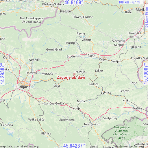
Zagorje ob Savi GPS coordinates[2]
46° 7' 54.444" North, 14° 59' 48.984" East
| Map corner | latitude | longitude |
|---|---|---|
| Upper-left | 46.6169°, | 14.29382° |
| Center: | 46.13179°, | 14.99694° |
| Lower-right: | 45.64237°, | 15.70007° |
| Map W x H: | 108.4×108.4 km | = 67.4×67.4mi |
| max Lat: | 46.83694° ⇑66.5% North |
| Zagorje ob Savi: | 46.13179° |
| min Lat: | ⇓33.5% South 45.47667° |
| min Long | Zagorje ob Savi | max Long |
| 13.52639° | 14.99694° | 16.4975° |
| W 49.3%⇐ | ⇒50.7% E |
Elevation
Elevation of Zagorje ob Savi is 244 m = 801 ft, and this is 81.6 m = 268 ft below average elevation for this country.
| Max E: |
1551 m = 5089 ft | 69.3% |
| Avg. | 325.6 m = 1068 ft | |
| Zagorje ob Savi | 244 m = 801 ft | |
Min E: |
2 m = 7 ft | 30.7% |
See also: Slovenia elevation on elevation.city.
Geographical zone
Zagorje ob Savi is located in North temperate zone (between Tropic of Cancer and the Arctic Circle). Distance of this North polar circle is 2271.8 km =1411.6 mi to North.| Distance of | km | miles | from Zagorje ob Savi |
|---|---|---|---|
| North Pole | 4877.7 | 3030.9 | to North |
| Arctic Circle | 2271.8 | 1411.6 | to North |
| Tropic Cancer | 2523.5 | 1568 | to South |
| Equator | 5129.4 | 3187.3 | to South |


Nearby cities:
15 places around Zagorje ob Savi: (largest is in red/bold)
• Dol pri Hrastniku
9 km =5.6 mi,  82°
82°
• Dolenja Vas
14.3 km =8.9 mi,  31°
31°
• Hrastnik
6.7 km =4.2 mi, 76°
• Izlake
4.1 km =2.5 mi,  299°
299°
• Kisovec
2.7 km =1.7 mi,  287°
287°
• Latkova Vas
15.5 km =9.6 mi, 28°
• Litija
15.7 km =9.8 mi,  238°
238°
• Pongrac
14.1 km =8.8 mi,  48°
48°
• Prebold
13.8 km =8.6 mi, 32°
• Rimske Toplice
15.1 km =9.4 mi,  93°
93°
• Tabor
11.7 km =7.3 mi,  8°
8°
• Trbovlje
5.1 km =3.2 mi,  59°
59°
• Vransko
12.9 km =8 mi,  344°
344°
• Zabukovica
15.5 km =9.6 mi, 53°
• Šmartno pri Litiji
15.3 km =9.5 mi,  230°
230°
Sources, notices
• [Note1] Compared only with cities in Slovenia existing in our database
• [Src1] Map data: © OpenStreetMap contributors (CC-BY-SA)
• [Src2] Other city data from geonames.org with taken over terms of usage.
• [Src3] Geographical zone / Annual Mean Temperature by Robert A. Rohde @ Wikipedia
