Trbovlje geodata
Trbovlje is a seat of a first-order administrative division; located in Slovenia in Europe/Ljubljana (GMT+2) time zone. With population of 15,163 people, there are 8 cities with bigger population in this country. Compared to other cities in Slovenia, 62.3% of cities are located further ↑North; 51.8% of cities are located further ←West and 54.8% of cities have higher elevation than Trbovlje. Note1


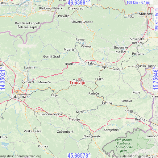
Trbovlje GPS coordinates[2]
46° 9' 18" North, 15° 3' 11.988" East
| Map corner | latitude | longitude |
|---|---|---|
| Upper-left | 46.63991°, | 14.35021° |
| Center: | 46.155°, | 15.05333° |
| Lower-right: | 45.66578°, | 15.75646° |
| Map W x H: | 108.3×108.3 km | = 67.3×67.3mi |
| max Lat: | 46.83694° ⇑62.3% North |
| Trbovlje: | 46.155° |
| min Lat: | ⇓37.7% South 45.47667° |
| min Long | Trbovlje | max Long |
| 13.52639° | 15.05333° | 16.4975° |
| W 51.8%⇐ | ⇒48.2% E |
Elevation
Elevation of Trbovlje is 285 m = 935 ft, and this is 40.6 m = 133 ft below average elevation for this country.
| Max E: |
1551 m = 5089 ft | 54.8% |
| Avg. | 325.6 m = 1068 ft | |
| Trbovlje | 285 m = 935 ft | |
Min E: |
2 m = 7 ft | 45.2% |
See also: Slovenia elevation on elevation.city.
Geographical zone
Trbovlje is located in North temperate zone (between Tropic of Cancer and the Arctic Circle). Distance of this North polar circle is 2269.2 km =1410 mi to North.| Distance of | km | miles | from Trbovlje |
|---|---|---|---|
| North Pole | 4875.1 | 3029.2 | to North |
| Arctic Circle | 2269.2 | 1410 | to North |
| Tropic Cancer | 2526 | 1569.6 | to South |
| Equator | 5132 | 3188.9 | to South |


Nearby cities:
15 places around Trbovlje: (largest is in red/bold)
• Dol pri Hrastniku
4.8 km =3 mi,  107°
107°
• Dolenja Vas
10.1 km =6.3 mi,  18°
18°
• Griže
11.2 km =7 mi,  42°
42°
• Hrastnik
2.4 km =1.5 mi, 114°
• Izlake
8 km =5 mi,  266°
266°
• Kisovec
7.2 km =4.5 mi,  255°
255°
• Latkova Vas
11.4 km =7.1 mi, 15°
• Migojnice
12.3 km =7.6 mi,  45°
45°
• Pongrac
9.2 km =5.7 mi, 41°
• Prebold
9.6 km =6 mi, 18°
• Rimske Toplice
11.3 km =7 mi, 108°
• Tabor
9.4 km =5.8 mi,  343°
343°
• Zabukovica
10.5 km =6.5 mi, 51°
• Zagorje ob Savi
5.1 km =3.2 mi,  239°
239°
• Šempeter v Savinj. Dolini
12.4 km =7.7 mi,  25°
25°
Sources, notices
• [Note1] Compared only with cities in Slovenia existing in our database
• [Src1] Map data: © OpenStreetMap contributors (CC-BY-SA)
• [Src2] Other city data from geonames.org with taken over terms of usage.
• [Src3] Geographical zone / Annual Mean Temperature by Robert A. Rohde @ Wikipedia
