Srednja Vas v Bohinju geodata
Srednja Vas v Bohinju (Radovljica) is a populated place; located in Slovenia in Europe/Ljubljana (GMT+2) time zone. With population of 505 people, there are 548 cities with bigger population in this country. Compared to other cities in Slovenia, 53.8% of cities are located further ↓South; 88.5% of cities are located further →East and 93.7% of cities have lower elevation than Srednja Vas v Bohinju. Note1


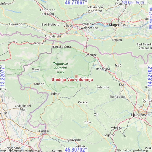
Srednja Vas v Bohinju GPS coordinates[2]
46° 17' 42" North, 13° 55' 26.004" East
| Map corner | latitude | longitude |
|---|---|---|
| Upper-left | 46.77867°, | 13.22077° |
| Center: | 46.295°, | 13.92389° |
| Lower-right: | 45.80702°, | 14.62702° |
| Map W x H: | 108×108 km | = 67.1×67.1mi |
| max Lat: | 46.83694° ⇑46.2% North |
| Srednja Vas v Bohinju: | 46.295° |
| min Lat: | ⇓53.8% South 45.47667° |
| min Long | Srednja Vas v B | max Long |
| 13.52639° | 13.92389° | 16.4975° |
| W 11.5%⇐ | ⇒88.5% E |
Elevation
Elevation of Srednja Vas v Bohinju is 585 m = 1919 ft, and this is 259.4 m = 851 ft above average elevation for this country.
| Max E: |
1551 m = 5089 ft | 6.3% |
| Srednja Vas v Bohinju | 585 m 1919 ft | |
| Avg. | 325.6 m = 1068 ft | |
Min E: |
2 m = 7 ft | 93.7% |
See also: Slovenia elevation on elevation.city.
Geographical zone
Srednja Vas v Bohinju is located in North temperate zone (between Tropic of Cancer and the Arctic Circle). Distance of this North polar circle is 2253.7 km =1400.4 mi to North.| Distance of | km | miles | from Srednja Vas v Bohinju |
|---|---|---|---|
| North Pole | 4859.5 | 3019.6 | to North |
| Arctic Circle | 2253.7 | 1400.4 | to North |
| Tropic Cancer | 2541.6 | 1579.3 | to South |
| Equator | 5147.5 | 3198.5 | to South |


Nearby cities:
15 places around Srednja Vas v Bohinju: (largest is in red/bold)
• Bled
16.7 km =10.4 mi,  60°
60°
• Blejska Dobrava
17.9 km =11.1 mi,  49°
49°
• Bohinjska Bela
12.3 km =7.6 mi, 60°
• Bohinjska Bistrica
3.4 km =2.1 mi,  138°
138°
• Hrušica
18.2 km =11.3 mi,  23°
23°
• Jesenice
18.6 km =11.6 mi,  36°
36°
• Mojstrana
14.8 km =9.2 mi,  345°
345°
• Podbrdo
10 km =6.2 mi,  161°
161°
• Ribno
14.7 km =9.1 mi,  75°
75°
• Slovenski Javornik
19.2 km =11.9 mi, 40°
• Spodnje Gorje
15.7 km =9.8 mi,  32°
32°
• Stara Fužina
6.9 km =4.3 mi,  298°
298°
• Tolmin
19.2 km =11.9 mi,  229°
229°
• Zasip
17.9 km =11.1 mi, 52°
• Zgornje Gorje
14.6 km =9.1 mi, 49°
Sources, notices
• [Note1] Compared only with cities in Slovenia existing in our database
• [Src1] Map data: © OpenStreetMap contributors (CC-BY-SA)
• [Src2] Other city data from geonames.org with taken over terms of usage.
• [Src3] Geographical zone / Annual Mean Temperature by Robert A. Rohde @ Wikipedia
