Mojstrana geodata
Mojstrana (Kranjska Gora) is a populated place; located in Slovenia in Europe/Ljubljana (GMT+2) time zone. With population of 1,175 people, there are 186 cities with bigger population in this country. Compared to other cities in Slovenia, 71.3% of cities are located further ↓South; 89% of cities are located further →East and 99% of cities have lower elevation than Mojstrana. Note1


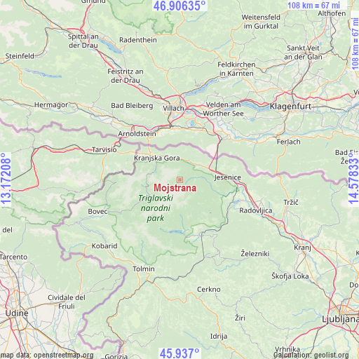
Mojstrana GPS coordinates[2]
46° 25' 25.788" North, 13° 52' 30.72" East
| Map corner | latitude | longitude |
|---|---|---|
| Upper-left | 46.90635°, | 13.17208° |
| Center: | 46.42383°, | 13.8752° |
| Lower-right: | 45.937°, | 14.57833° |
| Map W x H: | 107.8×107.8 km | = 67×67mi |
| max Lat: | 46.83694° ⇑28.7% North |
| Mojstrana: | 46.42383° |
| min Lat: | ⇓71.3% South 45.47667° |
| min Long | Mojstrana | max Long |
| 13.52639° | 13.8752° | 16.4975° |
| W 11%⇐ | ⇒89% E |
Elevation
Elevation of Mojstrana is 951 m = 3120 ft, and this is 625.4 m = 2052 ft above average elevation for this country.
| Max E: |
1551 m = 5089 ft | 1% |
| Mojstrana | 951 m 3120 ft | |
| Avg. | 325.6 m = 1068 ft | |
Min E: |
2 m = 7 ft | 99% |
See also: Slovenia elevation on elevation.city.
Geographical zone
Mojstrana is located in North temperate zone (between Tropic of Cancer and the Arctic Circle). Distance of this North polar circle is 2239.3 km =1391.4 mi to North.| Distance of | km | miles | from Mojstrana |
|---|---|---|---|
| North Pole | 4845.2 | 3010.7 | to North |
| Arctic Circle | 2239.3 | 1391.4 | to North |
| Tropic Cancer | 2555.9 | 1588.2 | to South |
| Equator | 5161.8 | 3207.4 | to South |


Nearby cities:
15 places around Mojstrana: (largest is in red/bold)
• Blejska Dobrava
17.4 km =10.8 mi,  98°
98°
• Bohinjska Bela
16.7 km =10.4 mi,  119°
119°
• Bohinjska Bistrica
17.9 km =11.1 mi,  160°
160°
• Dovje
8.9 km =5.5 mi,  56°
56°
• Gozd Martuljek
5.8 km =3.6 mi,  351°
351°
• Hrušica
11.2 km =7 mi,  77°
77°
• Jesenice
14.7 km =9.1 mi,  87°
87°
• Kranjska Gora
8.3 km =5.2 mi,  296°
296°
• Rateče
13.3 km =8.3 mi,  291°
291°
• Slovenski Javornik
16.3 km =10.1 mi, 89°
• Spodnje Gorje
12.3 km =7.6 mi, 95°
• Srednja Vas v Bohinju
14.8 km =9.2 mi,  165°
165°
• Stara Fužina
11.3 km =7 mi,  191°
191°
• Zasip
18.2 km =11.3 mi, 100°
• Zgornje Gorje
15.7 km =9.8 mi,  108°
108°
Sources, notices
• [Note1] Compared only with cities in Slovenia existing in our database
• [Src1] Map data: © OpenStreetMap contributors (CC-BY-SA)
• [Src2] Other city data from geonames.org with taken over terms of usage.
• [Src3] Geographical zone / Annual Mean Temperature by Robert A. Rohde @ Wikipedia
