Šmarca geodata
Šmarca (Kamnik) is a populated place; located in Slovenia in Europe/Ljubljana (GMT+2) time zone. With population of 1,441 people, there are 150 cities with bigger population in this country. Compared to other cities in Slovenia, 58.2% of cities are located further ↑North; 62% of cities are located further →East and 64.8% of cities have lower elevation than Šmarca. Note1


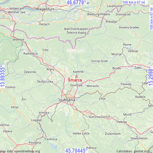
Šmarca GPS coordinates[2]
46° 11' 35.988" North, 14° 35' 48.012" East
| Map corner | latitude | longitude |
|---|---|---|
| Upper-left | 46.6779°, | 13.89355° |
| Center: | 46.19333°, | 14.59667° |
| Lower-right: | 45.70445°, | 15.2998° |
| Map W x H: | 108.2×108.2 km | = 67.2×67.2mi |
| max Lat: | 46.83694° ⇑58.2% North |
| Šmarca: | 46.19333° |
| min Lat: | ⇓41.8% South 45.47667° |
| min Long | Šmarca | max Long |
| 13.52639° | 14.59667° | 16.4975° |
| W 38%⇐ | ⇒62% E |
Elevation
Elevation of Šmarca is 346 m = 1135 ft, and this is 20.4 m = 67 ft above average elevation for this country.
| Max E: |
1551 m = 5089 ft | 35.2% |
| Šmarca | 346 m 1135 ft | |
| Avg. | 325.6 m = 1068 ft | |
Min E: |
2 m = 7 ft | 64.8% |
See also: Slovenia elevation on elevation.city.
Geographical zone
Šmarca is located in North temperate zone (between Tropic of Cancer and the Arctic Circle). Distance of this North polar circle is 2265 km =1407.4 mi to North.| Distance of | km | miles | from Šmarca |
|---|---|---|---|
| North Pole | 4870.8 | 3026.6 | to North |
| Arctic Circle | 2265 | 1407.4 | to North |
| Tropic Cancer | 2530.3 | 1572.3 | to South |
| Equator | 5136.2 | 3191.5 | to South |


Nearby cities:
15 places around Šmarca: (largest is in red/bold)
• Homec
1.1 km =0.7 mi,  167°
167°
• Kamnik
3.8 km =2.4 mi,  18°
18°
• Komenda
4.7 km =2.9 mi,  285°
285°
• Mekinje
4.7 km =2.9 mi, 19°
• Mengeš
3.4 km =2.1 mi,  209°
209°
• Moste
3.5 km =2.2 mi,  273°
273°
• Nožice
1 km =0.6 mi,  186°
186°
• Podgorje
2.8 km =1.7 mi,  338°
338°
• Preserje pri Radomljah
2.7 km =1.7 mi,  179°
179°
• Radomlje
2.5 km =1.6 mi,  151°
151°
• Rodica
5.1 km =3.2 mi, 183°
• Spodnje Jarše
4.8 km =3 mi, 176°
• Srednje Jarše
4.1 km =2.5 mi, 181°
• Suhadole
3.8 km =2.4 mi,  252°
252°
• Vir
4.5 km =2.8 mi, 169°
Sources, notices
• [Note1] Compared only with cities in Slovenia existing in our database
• [Src1] Map data: © OpenStreetMap contributors (CC-BY-SA)
• [Src2] Other city data from geonames.org with taken over terms of usage.
• [Src3] Geographical zone / Annual Mean Temperature by Robert A. Rohde @ Wikipedia
