Prevalje geodata
Prevalje is a seat of a first-order administrative division; located in Slovenia in Europe/Ljubljana (GMT+2) time zone. With population of 4,643 people, there are 43 cities with bigger population in this country. Compared to other cities in Slovenia, 84% of cities are located further ↓South; 52.3% of cities are located further →East and 76% of cities have lower elevation than Prevalje. Note1


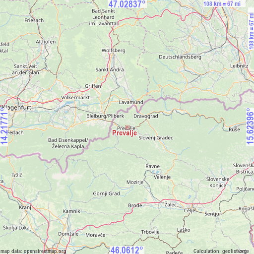
Prevalje GPS coordinates[2]
46° 32' 48.984" North, 14° 55' 14.988" East
| Map corner | latitude | longitude |
|---|---|---|
| Upper-left | 47.02837°, | 14.21771° |
| Center: | 46.54694°, | 14.92083° |
| Lower-right: | 46.0612°, | 15.62396° |
| Map W x H: | 107.5×107.5 km | = 66.8×66.8mi |
| max Lat: | 46.83694° ⇑16% North |
| Prevalje: | 46.54694° |
| min Lat: | ⇓84% South 45.47667° |
| min Long | Prevalje | max Long |
| 13.52639° | 14.92083° | 16.4975° |
| W 47.7%⇐ | ⇒52.3% E |
Elevation
Elevation of Prevalje is 409 m = 1342 ft, and this is 83.4 m = 274 ft above average elevation for this country.
| Max E: |
1551 m = 5089 ft | 24% |
| Prevalje | 409 m 1342 ft | |
| Avg. | 325.6 m = 1068 ft | |
Min E: |
2 m = 7 ft | 76% |
See also: Slovenia elevation on elevation.city.
Geographical zone
Prevalje is located in North temperate zone (between Tropic of Cancer and the Arctic Circle). Distance of this North polar circle is 2225.6 km =1382.9 mi to North.| Distance of | km | miles | from Prevalje |
|---|---|---|---|
| North Pole | 4831.5 | 3002.2 | to North |
| Arctic Circle | 2225.6 | 1382.9 | to North |
| Tropic Cancer | 2569.6 | 1596.7 | to South |
| Equator | 5175.5 | 3215.9 | to South |


Nearby cities:
15 places around Prevalje: (largest is in red/bold)
• Brdinje
6.2 km =3.9 mi,  104°
104°
• Dobja Vas
1.7 km =1.1 mi, 103°
• Dravograd
8.8 km =5.5 mi,  58°
58°
• Kotlje
5.8 km =3.6 mi,  119°
119°
• Leše
2.9 km =1.8 mi,  225°
225°
• Mežica
5.8 km =3.6 mi,  240°
240°
• Otiški Vrh
9.1 km =5.7 mi,  70°
70°
• Pameče
12.2 km =7.6 mi, 96°
• Podgorje
15 km =9.3 mi, 123°
• Ravne na Koroškem
3.7 km =2.3 mi, 96°
• Slovenj Gradec
12.9 km =8 mi,  108°
108°
• Stari Trg
12.3 km =7.6 mi, 115°
• Črna na Koroškem
10.1 km =6.3 mi,  212°
212°
• Črneče
7.7 km =4.8 mi,  52°
52°
• Šentjanž pri Dravogradu
9.2 km =5.7 mi,  80°
80°
Sources, notices
• [Note1] Compared only with cities in Slovenia existing in our database
• [Src1] Map data: © OpenStreetMap contributors (CC-BY-SA)
• [Src2] Other city data from geonames.org with taken over terms of usage.
• [Src3] Geographical zone / Annual Mean Temperature by Robert A. Rohde @ Wikipedia
