Podgorje geodata
Podgorje (Slovenj Gradec) is a populated place; located in Slovenia in Europe/Ljubljana (GMT+2) time zone. With population of 946 people, there are 233 cities with bigger population in this country. Compared to other cities in Slovenia, 76.2% of cities are located further ↓South; 54% of cities are located further ←West and 81.3% of cities have lower elevation than Podgorje. Note1


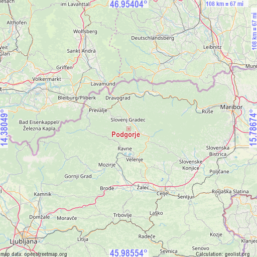
Podgorje GPS coordinates[2]
46° 28' 18.984" North, 15° 5' 0.996" East
| Map corner | latitude | longitude |
|---|---|---|
| Upper-left | 46.95404°, | 14.38049° |
| Center: | 46.47194°, | 15.08361° |
| Lower-right: | 45.98554°, | 15.78674° |
| Map W x H: | 107.7×107.7 km | = 66.9×66.9mi |
| max Lat: | 46.83694° ⇑23.8% North |
| Podgorje: | 46.47194° |
| min Lat: | ⇓76.2% South 45.47667° |
| min Long | Podgorje | max Long |
| 13.52639° | 15.08361° | 16.4975° |
| W 54%⇐ | ⇒46% E |
Elevation
Elevation of Podgorje is 442 m = 1450 ft, and this is 116.4 m = 382 ft above average elevation for this country.
| Max E: |
1551 m = 5089 ft | 18.7% |
| Podgorje | 442 m 1450 ft | |
| Avg. | 325.6 m = 1068 ft | |
Min E: |
2 m = 7 ft | 81.3% |
See also: Slovenia elevation on elevation.city.
Geographical zone
Podgorje is located in North temperate zone (between Tropic of Cancer and the Arctic Circle). Distance of this North polar circle is 2234 km =1388.1 mi to North.| Distance of | km | miles | from Podgorje |
|---|---|---|---|
| North Pole | 4839.9 | 3007.4 | to North |
| Arctic Circle | 2234 | 1388.1 | to North |
| Tropic Cancer | 2561.3 | 1591.5 | to South |
| Equator | 5167.2 | 3210.7 | to South |


Nearby cities:
15 places around Podgorje: (largest is in red/bold)
• Brdinje
9.4 km =5.8 mi,  316°
316°
• Florjan
10.5 km =6.5 mi,  213°
213°
• Gaberke
8.3 km =5.2 mi,  182°
182°
• Gornji Dolič
9.4 km =5.8 mi,  124°
124°
• Kotlje
9.2 km =5.7 mi,  306°
306°
• Legen
6 km =3.7 mi,  50°
50°
• Mislinja
9.6 km =6 mi,  110°
110°
• Mislinjska Dobrava
3.2 km =2 mi,  103°
103°
• Pameče
6.9 km =4.3 mi,  357°
357°
• Ravne
6.7 km =4.2 mi,  195°
195°
• Slovenj Gradec
4.3 km =2.7 mi, 356°
• Stari Trg
3.4 km =2.1 mi,  337°
337°
• Topolšica
9.3 km =5.8 mi, 210°
• Šentjanž pri Dravogradu
10.5 km =6.5 mi, 340°
• Šmartno pri Slovenj Gradcu
2.6 km =1.6 mi,  42°
42°
Sources, notices
• [Note1] Compared only with cities in Slovenia existing in our database
• [Src1] Map data: © OpenStreetMap contributors (CC-BY-SA)
• [Src2] Other city data from geonames.org with taken over terms of usage.
• [Src3] Geographical zone / Annual Mean Temperature by Robert A. Rohde @ Wikipedia
