Šentjanž pri Dravogradu geodata
Šentjanž pri Dravogradu (Dravograd) is a populated place; located in Slovenia in Europe/Ljubljana (GMT+2) time zone. With population of 543 people, there are 493 cities with bigger population in this country. Compared to other cities in Slovenia, 86.3% of cities are located further ↓South; 51.2% of cities are located further ←West and 66.5% of cities have lower elevation than Šentjanž pri Dravogradu. Note1
Current local time in Šentjanž pri Dravogradu:
05:35 AM, MondayDifference from your time zone: hours


Šentjanž pri Dravogradu GPS coordinates[2]
46° 33' 39.996" North, 15° 2' 20.004" East
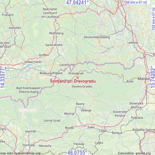
| Map corner | latitude | longitude |
|---|---|---|
| Upper-left | 47.04241°, | 14.33577° |
| Center: | 46.56111°, | 15.03889° |
| Lower-right: | 46.0755°, | 15.74202° |
| Map W x H: | 107.5×107.5 km | = 66.8×66.8mi |
| max Lat: | 46.83694° ⇑13.7% North |
| Šentjanž pri Dravogradu: | 46.56111° |
| min Lat: | ⇓86.3% South 45.47667° |
| min Long | Šentjanž pri | max Long |
| 13.52639° | 15.03889° | 16.4975° |
| W 51.2%⇐ | ⇒48.8% E |
Elevation
Elevation of Šentjanž pri Dravogradu is 352 m = 1155 ft, and this is 26.4 m = 87 ft above average elevation for this country.
| Max E: |
1551 m = 5089 ft | 33.5% |
| Šentjanž pri Dravogradu | 352 m 1155 ft | |
| Avg. | 325.6 m = 1068 ft | |
Min E: |
2 m = 7 ft | 66.5% |
See also: Slovenia elevation on elevation.city.
Geographical zone
Šentjanž pri Dravogradu is located in North temperate zone (between Tropic of Cancer and the Arctic Circle). Distance of this North polar circle is 2224.1 km =1382 mi to North.| Distance of | km | miles | from Šentjanž pri Dravogradu |
|---|---|---|---|
| North Pole | 4830 | 3001.2 | to North |
| Arctic Circle | 2224.1 | 1382 | to North |
| Tropic Cancer | 2571.2 | 1597.7 | to South |
| Equator | 5177.1 | 3216.9 | to South |


Nearby cities:
15 places around Šentjanž pri Dravogradu: (largest is in red/bold)
• Brdinje
4.3 km =2.7 mi,  223°
223°
• Dobja Vas
7.6 km =4.7 mi,  254°
254°
• Dravograd
3.4 km =2.1 mi,  333°
333°
• Gortina
8.3 km =5.2 mi,  53°
53°
• Kotlje
5.9 km =3.7 mi, 221°
• Legen
10.1 km =6.3 mi,  126°
126°
• Otiški Vrh
1.5 km =0.9 mi,  341°
341°
• Pameče
4.3 km =2.7 mi, 134°
• Podgorje
10.5 km =6.5 mi,  160°
160°
• Prevalje
9.2 km =5.7 mi,  260°
260°
• Ravne na Koroškem
5.7 km =3.5 mi, 249°
• Slovenj Gradec
6.5 km =4 mi,  150°
150°
• Stari Trg
7.1 km =4.4 mi, 162°
• Črneče
4.2 km =2.6 mi,  316°
316°
• Šmartno pri Slovenj Gradcu
9.5 km =5.9 mi, 146°
Sources, notices
• [Note1] Compared only with cities in Slovenia existing in our database
• [Src1] Map data: © OpenStreetMap contributors (CC-BY-SA)
• [Src2] Other city data from geonames.org with taken over terms of usage.
• [Src3] Geographical zone / Annual Mean Temperature by Robert A. Rohde @ Wikipedia
