Polzela geodata
Polzela is a seat of a first-order administrative division; located in Slovenia in Europe/Ljubljana (GMT+2) time zone. With population of 2,380 people, there are 82 cities with bigger population in this country. Compared to other cities in Slovenia, 52.7% of cities are located further ↓South; 52.7% of cities are located further ←West and 54.3% of cities have higher elevation than Polzela. Note1


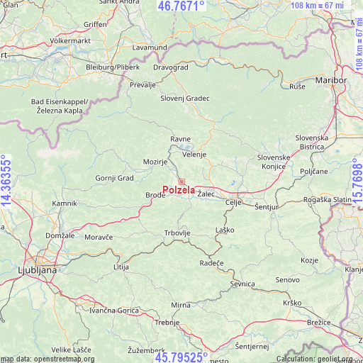
Polzela GPS coordinates[2]
46° 16' 59.988" North, 15° 4' 0.012" East
| Map corner | latitude | longitude |
|---|---|---|
| Upper-left | 46.7671°, | 14.36355° |
| Center: | 46.28333°, | 15.06667° |
| Lower-right: | 45.79525°, | 15.7698° |
| Map W x H: | 108.1×108.1 km | = 67.2×67.2mi |
| max Lat: | 46.83694° ⇑47.3% North |
| Polzela: | 46.28333° |
| min Lat: | ⇓52.7% South 45.47667° |
| min Long | Polzela | max Long |
| 13.52639° | 15.06667° | 16.4975° |
| W 52.7%⇐ | ⇒47.3% E |
Elevation
Elevation of Polzela is 288 m = 945 ft, and this is 37.6 m = 123 ft below average elevation for this country.
| Max E: |
1551 m = 5089 ft | 54.3% |
| Avg. | 325.6 m = 1068 ft | |
| Polzela | 288 m = 945 ft | |
Min E: |
2 m = 7 ft | 45.7% |
See also: Slovenia elevation on elevation.city.
Geographical zone
Polzela is located in North temperate zone (between Tropic of Cancer and the Arctic Circle). Distance of this North polar circle is 2255 km =1401.2 mi to North.| Distance of | km | miles | from Polzela |
|---|---|---|---|
| North Pole | 4860.8 | 3020.4 | to North |
| Arctic Circle | 2255 | 1401.2 | to North |
| Tropic Cancer | 2540.3 | 1578.5 | to South |
| Equator | 5146.2 | 3197.7 | to South |


Nearby cities:
15 places around Polzela: (largest is in red/bold)
• Andraž nad Polzelo
5 km =3.1 mi,  23°
23°
• Braslovče
2.2 km =1.4 mi,  288°
288°
• Breg pri Polzeli
2.2 km =1.4 mi,  133°
133°
• Dolenja Vas
5.2 km =3.2 mi,  155°
155°
• Gotovlje
6.6 km =4.1 mi,  98°
98°
• Latkova Vas
3.9 km =2.4 mi,  147°
147°
• Letuš
4.8 km =3 mi,  318°
318°
• Ločica ob Savinji
3.2 km =2 mi, 133°
• Parižlje
0.9 km =0.6 mi,  242°
242°
• Podkraj pri Velenju
7.9 km =4.9 mi,  12°
12°
• Prebold
5.5 km =3.4 mi, 158°
• Tabor
6.4 km =4 mi,  215°
215°
• Vrbje
7.4 km =4.6 mi,  120°
120°
• Šempeter v Savinj. Dolini
5.2 km =3.2 mi, 125°
• Šmartno ob Paki
6.1 km =3.8 mi,  335°
335°
Sources, notices
• [Note1] Compared only with cities in Slovenia existing in our database
• [Src1] Map data: © OpenStreetMap contributors (CC-BY-SA)
• [Src2] Other city data from geonames.org with taken over terms of usage.
• [Src3] Geographical zone / Annual Mean Temperature by Robert A. Rohde @ Wikipedia
