Njiverce geodata
Njiverce (Hajdina) is a populated place; located in Slovenia in Europe/Ljubljana (GMT+2) time zone. With population of 682 people, there are 368 cities with bigger population in this country. Compared to other cities in Slovenia, 68% of cities are located further ↓South; 82.8% of cities are located further ←West and 72.3% of cities have higher elevation than Njiverce. Note1


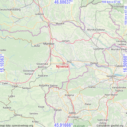
Njiverce GPS coordinates[2]
46° 24' 13.212" North, 15° 48' 24.3" East
| Map corner | latitude | longitude |
|---|---|---|
| Upper-left | 46.88637°, | 15.10363° |
| Center: | 46.40367°, | 15.80675° |
| Lower-right: | 45.91666°, | 16.50988° |
| Map W x H: | 107.8×107.8 km | = 67×67mi |
| max Lat: | 46.83694° ⇑32% North |
| Njiverce: | 46.40367° |
| min Lat: | ⇓68% South 45.47667° |
| min Long | Njiverce | max Long |
| 13.52639° | 15.80675° | 16.4975° |
| W 82.8%⇐ | ⇒17.2% E |
Elevation
Elevation of Njiverce is 236 m = 774 ft, and this is 89.6 m = 294 ft below average elevation for this country.
| Max E: |
1551 m = 5089 ft | 72.3% |
| Avg. | 325.6 m = 1068 ft | |
| Njiverce | 236 m = 774 ft | |
Min E: |
2 m = 7 ft | 27.7% |
See also: Slovenia elevation on elevation.city.
Geographical zone
Njiverce is located in North temperate zone (between Tropic of Cancer and the Arctic Circle). Distance of this North polar circle is 2241.6 km =1392.9 mi to North.| Distance of | km | miles | from Njiverce |
|---|---|---|---|
| North Pole | 4847.5 | 3012.1 | to North |
| Arctic Circle | 2241.6 | 1392.9 | to North |
| Tropic Cancer | 2553.7 | 1586.8 | to South |
| Equator | 5159.6 | 3206 | to South |


Nearby cities:
15 places around Njiverce: (largest is in red/bold)
• Apače
3 km =1.9 mi,  186°
186°
• Draženci
4 km =2.5 mi,  124°
124°
• Gerečja Vas
3.4 km =2.1 mi,  12°
12°
• Hajdoše
3.6 km =2.2 mi,  24°
24°
• Kidričevo
1.2 km =0.7 mi,  269°
269°
• Lancova Vas
5.3 km =3.3 mi,  133°
133°
• Lovrenc na Dravskem Polju
4 km =2.5 mi,  212°
212°
• Mestni Vrh
6.3 km =3.9 mi,  45°
45°
• Pobrežje
5.9 km =3.7 mi,  110°
110°
• Prepolje
5.6 km =3.5 mi,  323°
323°
• Ptuj
5.2 km =3.2 mi,  69°
69°
• Slovenja Vas
5.2 km =3.2 mi,  354°
354°
• Spodnja Hajdina
3.1 km =1.9 mi,  79°
79°
• Zgornja Hajdina
2.5 km =1.6 mi, 83°
• Zlatoličje
5.9 km =3.7 mi, 348°
Sources, notices
• [Note1] Compared only with cities in Slovenia existing in our database
• [Src1] Map data: © OpenStreetMap contributors (CC-BY-SA)
• [Src2] Other city data from geonames.org with taken over terms of usage.
• [Src3] Geographical zone / Annual Mean Temperature by Robert A. Rohde @ Wikipedia
