Lendava geodata
Lendava (Lendava-Lendva) is a seat of a first-order administrative division; located in Slovenia in Europe/Ljubljana (GMT+2) time zone. With population of 3,129 people, there are 66 cities with bigger population in this country. Compared to other cities in Slovenia, 86.8% of cities are located further ↓South; 99.5% of cities are located further ←West and 90% of cities have higher elevation than Lendava. Note1


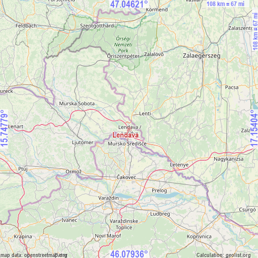
Lendava GPS coordinates[2]
46° 33' 53.784" North, 16° 27' 3.276" East
| Map corner | latitude | longitude |
|---|---|---|
| Upper-left | 47.04621°, | 15.74779° |
| Center: | 46.56494°, | 16.45091° |
| Lower-right: | 46.07936°, | 17.15404° |
| Map W x H: | 107.5×107.5 km | = 66.8×66.8mi |
| max Lat: | 46.83694° ⇑13.2% North |
| Lendava: | 46.56494° |
| min Lat: | ⇓86.8% South 45.47667° |
| min Long | Lendava | max Long |
| 13.52639° | 16.45091° | 16.4975° |
| W 99.5%⇐ | ⇒0.5% E |
Elevation
Elevation of Lendava is 164 m = 538 ft, and this is 161.6 m = 530 ft below average elevation for this country.
| Max E: |
1551 m = 5089 ft | 90% |
| Avg. | 325.6 m = 1068 ft | |
| Lendava | 164 m = 538 ft | |
Min E: |
2 m = 7 ft | 10% |
See also: Slovenia elevation on elevation.city.
Geographical zone
Lendava is located in North temperate zone (between Tropic of Cancer and the Arctic Circle). Distance of this North polar circle is 2223.6 km =1381.7 mi to North.| Distance of | km | miles | from Lendava |
|---|---|---|---|
| North Pole | 4829.5 | 3000.9 | to North |
| Arctic Circle | 2223.6 | 1381.7 | to North |
| Tropic Cancer | 2571.6 | 1597.9 | to South |
| Equator | 5177.5 | 3217.1 | to South |


Nearby cities:
15 places around Lendava: (largest is in red/bold)
• Dobrovnik
12.2 km =7.6 mi,  321°
321°
• Dolga Vas
2.6 km =1.6 mi,  344°
344°
• Dolnja Bistrica
12.7 km =7.9 mi,  257°
257°
• Gaberje
4.1 km =2.5 mi,  253°
253°
• Gomilica
11.4 km =7.1 mi,  291°
291°
• Hotiza
7.1 km =4.4 mi, 256°
• Lendavske Gorice
1.3 km =0.8 mi,  104°
104°
• Nedelica
10.7 km =6.6 mi,  302°
302°
• Petišovci
4.3 km =2.7 mi,  169°
169°
• Trnje
11.2 km =7 mi,  282°
282°
• Turnišče
12.2 km =7.6 mi, 304°
• Velika Polana
8 km =5 mi, 275°
• Čentiba
3.7 km =2.3 mi,  106°
106°
• Črenšovci
11.3 km =7 mi,  266°
266°
• Žižki
10.4 km =6.5 mi, 271°
Sources, notices
• [Note1] Compared only with cities in Slovenia existing in our database
• [Src1] Map data: © OpenStreetMap contributors (CC-BY-SA)
• [Src2] Other city data from geonames.org with taken over terms of usage.
• [Src3] Geographical zone / Annual Mean Temperature by Robert A. Rohde @ Wikipedia
