Laško geodata
Laško is a seat of a first-order administrative division; located in Slovenia in Europe/Ljubljana (GMT+2) time zone. With population of 3,456 people, there are 57 cities with bigger population in this country. Compared to other cities in Slovenia, 62.5% of cities are located further ↑North; 63% of cities are located further ←West and 75.2% of cities have higher elevation than Laško. Note1


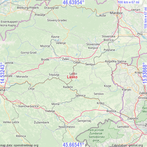
Laško GPS coordinates[2]
46° 9' 16.668" North, 15° 14' 7.98" East
| Map corner | latitude | longitude |
|---|---|---|
| Upper-left | 46.63954°, | 14.53243° |
| Center: | 46.15463°, | 15.23555° |
| Lower-right: | 45.66541°, | 15.93868° |
| Map W x H: | 108.3×108.3 km | = 67.3×67.3mi |
| max Lat: | 46.83694° ⇑62.5% North |
| Laško: | 46.15463° |
| min Lat: | ⇓37.5% South 45.47667° |
| min Long | Laško | max Long |
| 13.52639° | 15.23555° | 16.4975° |
| W 63%⇐ | ⇒37% E |
Elevation
Elevation of Laško is 226 m = 741 ft, and this is 99.6 m = 327 ft below average elevation for this country.
| Max E: |
1551 m = 5089 ft | 75.2% |
| Avg. | 325.6 m = 1068 ft | |
| Laško | 226 m = 741 ft | |
Min E: |
2 m = 7 ft | 24.8% |
See also: Slovenia elevation on elevation.city.
Geographical zone
Laško is located in North temperate zone (between Tropic of Cancer and the Arctic Circle). Distance of this North polar circle is 2269.3 km =1410.1 mi to North.| Distance of | km | miles | from Laško |
|---|---|---|---|
| North Pole | 4875.1 | 3029.2 | to North |
| Arctic Circle | 2269.3 | 1410.1 | to North |
| Tropic Cancer | 2526 | 1569.6 | to South |
| Equator | 5131.9 | 3188.8 | to South |


Nearby cities:
15 places around Laško: (largest is in red/bold)
• Celje
8.7 km =5.4 mi,  12°
12°
• Dol pri Hrastniku
9.6 km =6 mi,  261°
261°
• Griže
10.6 km =6.6 mi,  321°
321°
• Kasaze
9.2 km =5.7 mi,  342°
342°
• Košnica pri Celju
6.9 km =4.3 mi,  358°
358°
• Liboje
7 km =4.3 mi,  333°
333°
• Lopata
11.8 km =7.3 mi, 357°
• Migojnice
10.2 km =6.3 mi, 328°
• Petrovče
10.3 km =6.4 mi, 340°
• Pongrac
10.5 km =6.5 mi,  311°
311°
• Radeče
10.4 km =6.5 mi,  202°
202°
• Rimske Toplice
4.9 km =3 mi,  223°
223°
• Spodnja Rečica
1.9 km =1.2 mi,  304°
304°
• Zabukovica
8.8 km =5.5 mi, 318°
• Štore
9.5 km =5.9 mi,  39°
39°
Sources, notices
• [Note1] Compared only with cities in Slovenia existing in our database
• [Src1] Map data: © OpenStreetMap contributors (CC-BY-SA)
• [Src2] Other city data from geonames.org with taken over terms of usage.
• [Src3] Geographical zone / Annual Mean Temperature by Robert A. Rohde @ Wikipedia
