Horjul geodata
Horjul is a seat of a first-order administrative division; located in Slovenia in Europe/Ljubljana (GMT+2) time zone. With population of 1,329 people, there are 164 cities with bigger population in this country. Compared to other cities in Slovenia, 71.5% of cities are located further ↑North; 77.7% of cities are located further →East and 65.3% of cities have lower elevation than Horjul. Note1


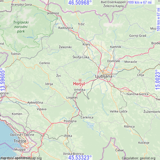
Horjul GPS coordinates[2]
46° 1' 24.996" North, 14° 17' 57.012" East
| Map corner | latitude | longitude |
|---|---|---|
| Upper-left | 46.50968°, | 13.59605° |
| Center: | 46.02361°, | 14.29917° |
| Lower-right: | 45.53323°, | 15.0023° |
| Map W x H: | 108.6×108.6 km | = 67.5×67.5mi |
| max Lat: | 46.83694° ⇑71.5% North |
| Horjul: | 46.02361° |
| min Lat: | ⇓28.5% South 45.47667° |
| min Long | Horjul | max Long |
| 13.52639° | 14.29917° | 16.4975° |
| W 22.3%⇐ | ⇒77.7% E |
Elevation
Elevation of Horjul is 348 m = 1142 ft, and this is 22.4 m = 73 ft above average elevation for this country.
| Max E: |
1551 m = 5089 ft | 34.7% |
| Horjul | 348 m 1142 ft | |
| Avg. | 325.6 m = 1068 ft | |
Min E: |
2 m = 7 ft | 65.3% |
See also: Slovenia elevation on elevation.city.
Geographical zone
Horjul is located in North temperate zone (between Tropic of Cancer and the Arctic Circle). Distance of this North polar circle is 2283.8 km =1419.1 mi to North.| Distance of | km | miles | from Horjul |
|---|---|---|---|
| North Pole | 4889.7 | 3038.3 | to North |
| Arctic Circle | 2283.8 | 1419.1 | to North |
| Tropic Cancer | 2511.4 | 1560.5 | to South |
| Equator | 5117.3 | 3179.7 | to South |


Nearby cities:
15 places around Horjul: (largest is in red/bold)
• Bevke
6.2 km =3.9 mi,  135°
135°
• Brezovica pri Ljubljani
7.9 km =4.9 mi,  82°
82°
• Dobrova
7.6 km =4.7 mi,  70°
70°
• Dragomer
6.5 km =4 mi,  96°
96°
• Drenov Grič
3.9 km =2.4 mi, 137°
• Log pri Brezovici
5.3 km =3.3 mi, 98°
• Lukovica pri Brezovici
7.4 km =4.6 mi, 97°
• Notranje Gorice
8.7 km =5.4 mi,  117°
117°
• Polhov Gradec
5 km =3.1 mi,  15°
15°
• Sinja Gorica
5.5 km =3.4 mi,  164°
164°
• Stara Vrhnika
5.7 km =3.5 mi,  194°
194°
• Verd
7.5 km =4.7 mi,  176°
176°
• Vnanje Gorice
9.7 km =6 mi, 100°
• Vrhnika
6.7 km =4.2 mi, 182°
• Vrzdenec
2.2 km =1.4 mi,  260°
260°
Sources, notices
• [Note1] Compared only with cities in Slovenia existing in our database
• [Src1] Map data: © OpenStreetMap contributors (CC-BY-SA)
• [Src2] Other city data from geonames.org with taken over terms of usage.
• [Src3] Geographical zone / Annual Mean Temperature by Robert A. Rohde @ Wikipedia
