Stara Vrhnika geodata
Stara Vrhnika (Vrhnika) is a populated place; located in Slovenia in Europe/Ljubljana (GMT+2) time zone. With population of 730 people, there are 342 cities with bigger population in this country. Compared to other cities in Slovenia, 75.7% of cities are located further ↑North; 79.2% of cities are located further →East and 57.8% of cities have lower elevation than Stara Vrhnika. Note1


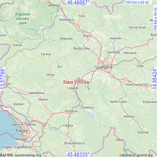
Stara Vrhnika GPS coordinates[2]
45° 58' 27.012" North, 14° 16' 51.996" East
| Map corner | latitude | longitude |
|---|---|---|
| Upper-left | 46.46067°, | 13.57799° |
| Center: | 45.97417°, | 14.28111° |
| Lower-right: | 45.48335°, | 14.98424° |
| Map W x H: | 108.7×108.7 km | = 67.5×67.5mi |
| max Lat: | 46.83694° ⇑75.7% North |
| Stara Vrhnika: | 45.97417° |
| min Lat: | ⇓24.3% South 45.47667° |
| min Long | Stara Vrhnika | max Long |
| 13.52639° | 14.28111° | 16.4975° |
| W 20.8%⇐ | ⇒79.2% E |
Elevation
Elevation of Stara Vrhnika is 319 m = 1047 ft, and this is 6.6 m = 22 ft below average elevation for this country.
| Max E: |
1551 m = 5089 ft | 42.2% |
| Avg. | 325.6 m = 1068 ft | |
| Stara Vrhnika | 319 m = 1047 ft | |
Min E: |
2 m = 7 ft | 57.8% |
See also: Slovenia elevation on elevation.city.
Geographical zone
Stara Vrhnika is located in North temperate zone (between Tropic of Cancer and the Arctic Circle). Distance of this North polar circle is 2289.3 km =1422.5 mi to North.| Distance of | km | miles | from Stara Vrhnika |
|---|---|---|---|
| North Pole | 4895.2 | 3041.7 | to North |
| Arctic Circle | 2289.3 | 1422.5 | to North |
| Tropic Cancer | 2505.9 | 1557.1 | to South |
| Equator | 5111.8 | 3176.3 | to South |


Nearby cities:
15 places around Stara Vrhnika: (largest is in red/bold)
• Bevke
5.9 km =3.7 mi,  79°
79°
• Borovnica
9.1 km =5.7 mi,  135°
135°
• Dragomer
9.2 km =5.7 mi,  59°
59°
• Drenov Grič
4.8 km =3 mi, 56°
• Horjul
5.7 km =3.5 mi,  14°
14°
• Kamnik pod Krimom
10.2 km =6.3 mi,  107°
107°
• Log pri Brezovici
8.1 km =5 mi,  54°
54°
• Logatec
7.9 km =4.9 mi,  212°
212°
• Lukovica pri Brezovici
9.8 km =6.1 mi, 62°
• Notranje Gorice
9.2 km =5.7 mi, 80°
• Rovte
8.1 km =5 mi,  278°
278°
• Sinja Gorica
2.9 km =1.8 mi,  86°
86°
• Verd
2.7 km =1.7 mi, 135°
• Vrhnika
1.6 km =1 mi, 138°
• Vrzdenec
5.2 km =3.2 mi,  351°
351°
Sources, notices
• [Note1] Compared only with cities in Slovenia existing in our database
• [Src1] Map data: © OpenStreetMap contributors (CC-BY-SA)
• [Src2] Other city data from geonames.org with taken over terms of usage.
• [Src3] Geographical zone / Annual Mean Temperature by Robert A. Rohde @ Wikipedia
