Brestanica geodata
Brestanica (Krško) is a populated place; located in Slovenia in Europe/Ljubljana (GMT+2) time zone. With population of 993 people, there are 217 cities with bigger population in this country. Compared to other cities in Slovenia, 74% of cities are located further ↑North; 68.2% of cities are located further ←West and 83.2% of cities have higher elevation than Brestanica. Note1


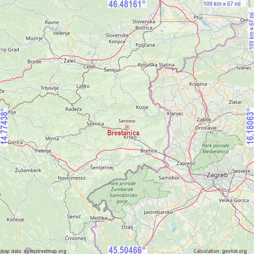
Brestanica GPS coordinates[2]
45° 59' 43.044" North, 15° 28' 39" East
| Map corner | latitude | longitude |
|---|---|---|
| Upper-left | 46.48161°, | 14.77438° |
| Center: | 45.99529°, | 15.4775° |
| Lower-right: | 45.50466°, | 16.18063° |
| Map W x H: | 108.6×108.6 km | = 67.5×67.5mi |
| max Lat: | 46.83694° ⇑74% North |
| Brestanica: | 45.99529° |
| min Lat: | ⇓26% South 45.47667° |
| min Long | Brestanica | max Long |
| 13.52639° | 15.4775° | 16.4975° |
| W 68.2%⇐ | ⇒31.8% E |
Elevation
Elevation of Brestanica is 186 m = 610 ft, and this is 139.6 m = 458 ft below average elevation for this country.
| Max E: |
1551 m = 5089 ft | 83.2% |
| Avg. | 325.6 m = 1068 ft | |
| Brestanica | 186 m = 610 ft | |
Min E: |
2 m = 7 ft | 16.8% |
See also: Slovenia elevation on elevation.city.
Geographical zone
Brestanica is located in North temperate zone (between Tropic of Cancer and the Arctic Circle). Distance of this North polar circle is 2287 km =1421.1 mi to North.| Distance of | km | miles | from Brestanica |
|---|---|---|---|
| North Pole | 4892.9 | 3040.3 | to North |
| Arctic Circle | 2287 | 1421.1 | to North |
| Tropic Cancer | 2508.3 | 1558.6 | to South |
| Equator | 5114.2 | 3177.8 | to South |


Nearby cities:
15 places around Brestanica: (largest is in red/bold)
• Bistrica ob Sotli
16.1 km =10 mi,  63°
63°
• Bizeljsko
16.8 km =10.4 mi,  82°
82°
• Brežice
13.5 km =8.4 mi,  139°
139°
• Dobje pri Planini
17.1 km =10.6 mi,  337°
337°
• Dobova
18.1 km =11.2 mi,  127°
127°
• Dolenji Boštanj
14.5 km =9 mi,  276°
276°
• Kostanjevica na Krki
17.1 km =10.6 mi,  194°
194°
• Kozje
10.9 km =6.8 mi,  35°
35°
• Krška Vas
12.6 km =7.8 mi,  146°
146°
• Krško
4.2 km =2.6 mi,  164°
164°
• Leskovec pri Krškem
6.6 km =4.1 mi,  183°
183°
• Sela pri Dobovi
14.9 km =9.3 mi, 125°
• Senovo
3.1 km =1.9 mi,  359°
359°
• Sevnica
12.6 km =7.8 mi, 276°
• Škocjan
17.4 km =10.8 mi,  235°
235°
Sources, notices
• [Note1] Compared only with cities in Slovenia existing in our database
• [Src1] Map data: © OpenStreetMap contributors (CC-BY-SA)
• [Src2] Other city data from geonames.org with taken over terms of usage.
• [Src3] Geographical zone / Annual Mean Temperature by Robert A. Rohde @ Wikipedia
