Dobje pri Planini geodata
Dobje pri Planini (Dobje) is a seat of a first-order administrative division; located in Slovenia in Europe/Ljubljana (GMT+2) time zone. With population of 116 people, there are 596 cities with bigger population in this country. Compared to other cities in Slovenia, 65.3% of cities are located further ↑North; 66.5% of cities are located further ←West and 92.5% of cities have lower elevation than Dobje pri Planini. Note1


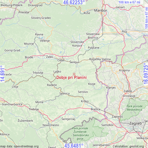
Dobje pri Planini GPS coordinates[2]
46° 8' 14.892" North, 15° 23' 38.832" East
| Map corner | latitude | longitude |
|---|---|---|
| Upper-left | 46.62253°, | 14.691° |
| Center: | 46.13747°, | 15.39412° |
| Lower-right: | 45.6481°, | 16.09725° |
| Map W x H: | 108.3×108.3 km | = 67.3×67.3mi |
| max Lat: | 46.83694° ⇑65.3% North |
| Dobje pri Planini: | 46.13747° |
| min Lat: | ⇓34.7% South 45.47667° |
| min Long | Dobje pri Plani | max Long |
| 13.52639° | 15.39412° | 16.4975° |
| W 66.5%⇐ | ⇒33.5% E |
Elevation
Elevation of Dobje pri Planini is 563 m = 1847 ft, and this is 237.4 m = 779 ft above average elevation for this country.
| Max E: |
1551 m = 5089 ft | 7.5% |
| Dobje pri Planini | 563 m 1847 ft | |
| Avg. | 325.6 m = 1068 ft | |
Min E: |
2 m = 7 ft | 92.5% |
See also: Slovenia elevation on elevation.city.
Geographical zone
Dobje pri Planini is located in North temperate zone (between Tropic of Cancer and the Arctic Circle). Distance of this North polar circle is 2271.2 km =1411.3 mi to North.| Distance of | km | miles | from Dobje pri Planini |
|---|---|---|---|
| North Pole | 4877.1 | 3030.5 | to North |
| Arctic Circle | 2271.2 | 1411.3 | to North |
| Tropic Cancer | 2524.1 | 1568.4 | to South |
| Equator | 5130 | 3187.6 | to South |


Nearby cities:
15 places around Dobje pri Planini: (largest is in red/bold)
• Celje
14.6 km =9.1 mi,  315°
315°
• Gorica pri Slivnici
6.3 km =3.9 mi,  28°
28°
• Kozje
14.6 km =9.1 mi,  118°
118°
• Košnica pri Celju
15.2 km =9.4 mi,  305°
305°
• Laško
12.4 km =7.7 mi,  278°
278°
• Ljubečna
14.2 km =8.8 mi,  337°
337°
• Podčetrtek
15.9 km =9.9 mi,  82°
82°
• Rimske Toplice
15.7 km =9.8 mi,  263°
263°
• Senovo
14.2 km =8.8 mi,  153°
153°
• Sevnica
15.6 km =9.7 mi,  202°
202°
• Spodnja Rečica
14.1 km =8.8 mi, 282°
• Trnovlje pri Celju
15.3 km =9.5 mi,  330°
330°
• Šentjur
8.9 km =5.5 mi,  1°
1°
• Šmarje pri Jelšah
13.9 km =8.6 mi,  43°
43°
• Štore
11.1 km =6.9 mi, 326°
Sources, notices
• [Note1] Compared only with cities in Slovenia existing in our database
• [Src1] Map data: © OpenStreetMap contributors (CC-BY-SA)
• [Src2] Other city data from geonames.org with taken over terms of usage.
• [Src3] Geographical zone / Annual Mean Temperature by Robert A. Rohde @ Wikipedia
