Studence geodata
Studence (Žalec) is a populated place; located in Slovenia in Europe/Ljubljana (GMT+2) time zone. With population of 600 people, there are 440 cities with bigger population in this country. Compared to other cities in Slovenia, 55.5% of cities are located further ↓South; 58.2% of cities are located further ←West and 78.5% of cities have lower elevation than Studence. Note1


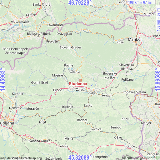
Studence GPS coordinates[2]
46° 18' 31.464" North, 15° 9' 45.9" East
| Map corner | latitude | longitude |
|---|---|---|
| Upper-left | 46.79228°, | 14.45963° |
| Center: | 46.30874°, | 15.16275° |
| Lower-right: | 45.82089°, | 15.86588° |
| Map W x H: | 108×108 km | = 67.1×67.1mi |
| max Lat: | 46.83694° ⇑44.5% North |
| Studence: | 46.30874° |
| min Lat: | ⇓55.5% South 45.47667° |
| min Long | Studence | max Long |
| 13.52639° | 15.16275° | 16.4975° |
| W 58.2%⇐ | ⇒41.8% E |
Elevation
Elevation of Studence is 419 m = 1375 ft, and this is 93.4 m = 306 ft above average elevation for this country.
| Max E: |
1551 m = 5089 ft | 21.5% |
| Studence | 419 m 1375 ft | |
| Avg. | 325.6 m = 1068 ft | |
Min E: |
2 m = 7 ft | 78.5% |
See also: Slovenia elevation on elevation.city.
Geographical zone
Studence is located in North temperate zone (between Tropic of Cancer and the Arctic Circle). Distance of this North polar circle is 2252.1 km =1399.4 mi to North.| Distance of | km | miles | from Studence |
|---|---|---|---|
| North Pole | 4858 | 3018.6 | to North |
| Arctic Circle | 2252.1 | 1399.4 | to North |
| Tropic Cancer | 2543.1 | 1580.2 | to South |
| Equator | 5149 | 3199.4 | to South |


Nearby cities:
15 places around Studence: (largest is in red/bold)
• Andraž nad Polzelo
5.7 km =3.5 mi,  288°
288°
• Arja Vas
5.9 km =3.7 mi,  160°
160°
• Breg pri Polzeli
7.2 km =4.5 mi,  232°
232°
• Dobrna
5.8 km =3.6 mi,  56°
56°
• Galicija
2.7 km =1.7 mi,  112°
112°
• Gorica pri Šmartnem
6.5 km =4 mi,  126°
126°
• Gotovlje
3.9 km =2.4 mi,  192°
192°
• Lopata
7.4 km =4.6 mi,  136°
136°
• Ločica ob Savinji
7.1 km =4.4 mi, 225°
• Pernovo
2.7 km =1.7 mi, 138°
• Podkraj pri Velenju
7.5 km =4.7 mi,  310°
310°
• Velenje
6.9 km =4.3 mi,  324°
324°
• Vrbje
6.6 km =4.1 mi, 188°
• Šempeter v Savinj. Dolini
6.6 km =4.1 mi,  208°
208°
• Žalec
6.4 km =4 mi,  178°
178°
Sources, notices
• [Note1] Compared only with cities in Slovenia existing in our database
• [Src1] Map data: © OpenStreetMap contributors (CC-BY-SA)
• [Src2] Other city data from geonames.org with taken over terms of usage.
• [Src3] Geographical zone / Annual Mean Temperature by Robert A. Rohde @ Wikipedia
