Dobrna geodata
Dobrna is a seat of a first-order administrative division; located in Slovenia in Europe/Ljubljana (GMT+2) time zone. With population of 548 people, there are 486 cities with bigger population in this country. Compared to other cities in Slovenia, 58.5% of cities are located further ↓South; 62.2% of cities are located further ←West and 71.8% of cities have lower elevation than Dobrna. Note1


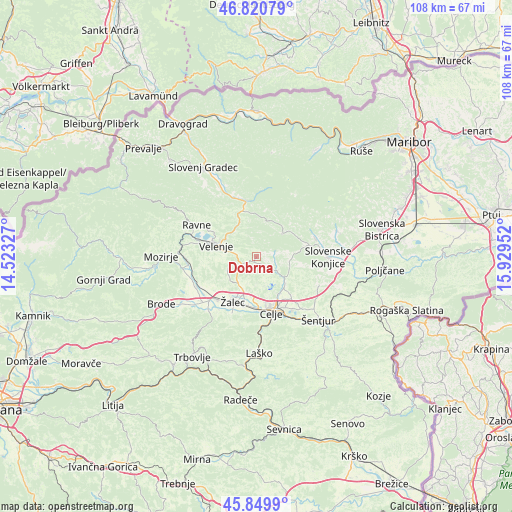
Dobrna GPS coordinates[2]
46° 20' 15" North, 15° 13' 35.004" East
| Map corner | latitude | longitude |
|---|---|---|
| Upper-left | 46.82079°, | 14.52327° |
| Center: | 46.3375°, | 15.22639° |
| Lower-right: | 45.8499°, | 15.92952° |
| Map W x H: | 108×108 km | = 67.1×67.1mi |
| max Lat: | 46.83694° ⇑41.5% North |
| Dobrna: | 46.3375° |
| min Lat: | ⇓58.5% South 45.47667° |
| min Long | Dobrna | max Long |
| 13.52639° | 15.22639° | 16.4975° |
| W 62.2%⇐ | ⇒37.8% E |
Elevation
Elevation of Dobrna is 381 m = 1250 ft, and this is 55.4 m = 182 ft above average elevation for this country.
| Max E: |
1551 m = 5089 ft | 28.2% |
| Dobrna | 381 m 1250 ft | |
| Avg. | 325.6 m = 1068 ft | |
Min E: |
2 m = 7 ft | 71.8% |
See also: Slovenia elevation on elevation.city.
Geographical zone
Dobrna is located in North temperate zone (between Tropic of Cancer and the Arctic Circle). Distance of this North polar circle is 2248.9 km =1397.4 mi to North.| Distance of | km | miles | from Dobrna |
|---|---|---|---|
| North Pole | 4854.8 | 3016.6 | to North |
| Arctic Circle | 2248.9 | 1397.4 | to North |
| Tropic Cancer | 2546.3 | 1582.2 | to South |
| Equator | 5152.2 | 3201.4 | to South |


Nearby cities:
15 places around Dobrna: (largest is in red/bold)
• Andraž nad Polzelo
10.4 km =6.5 mi,  262°
262°
• Arja Vas
9.2 km =5.7 mi,  198°
198°
• Galicija
4.9 km =3 mi,  209°
209°
• Gorica pri Šmartnem
7 km =4.3 mi,  177°
177°
• Gornji Dolič
10.1 km =6.3 mi,  341°
341°
• Gotovlje
9.1 km =5.7 mi,  219°
219°
• Lopata
8.6 km =5.3 mi, 178°
• Pernovo
6.1 km =3.8 mi, 210°
• Studence
5.8 km =3.6 mi,  236°
236°
• Trnovlje pri Celju
10.4 km =6.5 mi,  149°
149°
• Velenje
9.2 km =5.7 mi,  285°
285°
• Vitanje
7.2 km =4.5 mi,  47°
47°
• Vojnik
7.7 km =4.8 mi,  129°
129°
• Zadobrova
10 km =6.2 mi,  143°
143°
• Škale
10.3 km =6.4 mi, 294°
Sources, notices
• [Note1] Compared only with cities in Slovenia existing in our database
• [Src1] Map data: © OpenStreetMap contributors (CC-BY-SA)
• [Src2] Other city data from geonames.org with taken over terms of usage.
• [Src3] Geographical zone / Annual Mean Temperature by Robert A. Rohde @ Wikipedia
