Gabernik geodata
Gabernik (Slovenska Bistrica) is a populated place; located in Slovenia in Europe/Ljubljana (GMT+2) time zone. With population of 564 people, there are 469 cities with bigger population in this country. Compared to other cities in Slovenia, 71.7% of cities are located further ↓South; 72.2% of cities are located further ←West and 71.8% of cities have lower elevation than Gabernik. Note1


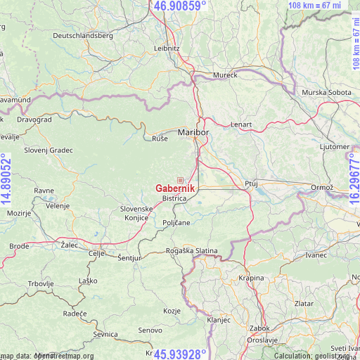
Gabernik GPS coordinates[2]
46° 25' 33.924" North, 15° 35' 37.104" East
| Map corner | latitude | longitude |
|---|---|---|
| Upper-left | 46.90859°, | 14.89052° |
| Center: | 46.42609°, | 15.59364° |
| Lower-right: | 45.93928°, | 16.29677° |
| Map W x H: | 107.8×107.8 km | = 67×67mi |
| max Lat: | 46.83694° ⇑28.3% North |
| Gabernik: | 46.42609° |
| min Lat: | ⇓71.7% South 45.47667° |
| min Long | Gabernik | max Long |
| 13.52639° | 15.59364° | 16.4975° |
| W 72.2%⇐ | ⇒27.8% E |
Elevation
Elevation of Gabernik is 381 m = 1250 ft, and this is 55.4 m = 182 ft above average elevation for this country.
| Max E: |
1551 m = 5089 ft | 28.2% |
| Gabernik | 381 m 1250 ft | |
| Avg. | 325.6 m = 1068 ft | |
Min E: |
2 m = 7 ft | 71.8% |
See also: Slovenia elevation on elevation.city.
Geographical zone
Gabernik is located in North temperate zone (between Tropic of Cancer and the Arctic Circle). Distance of this North polar circle is 2239.1 km =1391.3 mi to North.| Distance of | km | miles | from Gabernik |
|---|---|---|---|
| North Pole | 4845 | 3010.5 | to North |
| Arctic Circle | 2239.1 | 1391.3 | to North |
| Tropic Cancer | 2556.2 | 1588.3 | to South |
| Equator | 5162.1 | 3207.6 | to South |


Nearby cities:
15 places around Gabernik: (largest is in red/bold)
• Fram
4.3 km =2.7 mi,  40°
40°
• Gaj
6.5 km =4 mi,  110°
110°
• Hotinja Vas
7.2 km =4.5 mi,  51°
51°
• Kovača Vas
3.1 km =1.9 mi,  236°
236°
• Leskovec
5.6 km =3.5 mi,  147°
147°
• Morje
2.9 km =1.8 mi, 46°
• Pragersko
6 km =3.7 mi,  122°
122°
• Radizel
7.2 km =4.5 mi, 41°
• Slivnica pri Mariboru
7.3 km =4.5 mi, 40°
• Slovenska Bistrica
4 km =2.5 mi,  201°
201°
• Spodnja Polskava
3.9 km =2.4 mi, 116°
• Visole
5.7 km =3.5 mi, 243°
• Zgornja Bistrica
4.9 km =3 mi,  232°
232°
• Zgornja Polskava
1.4 km =0.9 mi,  92°
92°
• Črešnjevec
5.9 km =3.7 mi,  162°
162°
Sources, notices
• [Note1] Compared only with cities in Slovenia existing in our database
• [Src1] Map data: © OpenStreetMap contributors (CC-BY-SA)
• [Src2] Other city data from geonames.org with taken over terms of usage.
• [Src3] Geographical zone / Annual Mean Temperature by Robert A. Rohde @ Wikipedia
