Ad Duraykīsh geodata
Ad Duraykīsh (Tartus) is a seat of a second-order administrative division; located in Syria in Asia/Damascus (GMT+3) time zone. With population of 11,918 people, there are 78 cities with bigger population in this country. Compared to other cities in Syria, 59.4% of cities are located further ↑North; 80.6% of cities are located further →East and 56.2% of cities have higher elevation than Ad Duraykīsh. Note1


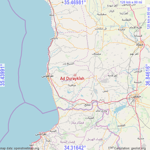
Ad Duraykīsh GPS coordinates[2]
34° 53' 42.504" North, 36° 8' 34.908" East
| Map corner | latitude | longitude |
|---|---|---|
| Upper-left | 35.46981°, | 35.43991° |
| Center: | 34.89514°, | 36.14303° |
| Lower-right: | 34.31642°, | 36.84616° |
| Map W x H: | 128.2×128.2 km | = 79.7×79.7mi |
| max Lat: | 37.17701° ⇑59.4% North |
| Ad Duraykīsh: | 34.89514° |
| min Lat: | ⇓40.6% South 32.39332° |
| min Long | Ad Duraykīsh | max Long |
| 35.75572° | 36.14303° | 42.14006° |
| W 19.4%⇐ | ⇒80.6% E |
Elevation
Elevation of Ad Duraykīsh is 436 m = 1430 ft, and this is 93.1 m = 305 ft below average elevation for this country.
| Max E: |
1640 m = 5381 ft | 56.2% |
| Avg. | 529.1 m = 1736 ft | |
| Ad Duraykīsh | 436 m = 1430 ft | |
Min E: |
4 m = 13 ft | 43.8% |
See also: Syria elevation on elevation.city.
Geographical zone
Ad Duraykīsh is located in North temperate zone (between Tropic of Cancer and the Arctic Circle). Distance of this Northern Tropic circle is 1274.1 km =791.7 mi to South.| Distance of | km | miles | from Ad Duraykīsh |
|---|---|---|---|
| North Pole | 6127.1 | 3807.2 | to North |
| Arctic Circle | 3521.2 | 2188 | to North |
| Tropic Cancer | 1274.1 | 791.7 | to South |
| Equator | 3880 | 2410.9 | to South |


Nearby cities:
15 places around Ad Duraykīsh: (largest is in red/bold)
• Al Bāriqīyah
10.7 km =6.6 mi,  133°
133°
• An Nāşirah
17.7 km =11 mi, 132°
• As Sīsnīyah
12.7 km =7.9 mi,  180°
180°
• Ash Shaykh Badr
12 km =7.5 mi,  333°
333°
• Brummānat al Mashāyikh
14 km =8.7 mi,  10°
10°
• Duwayr Raslān
7 km =4.3 mi,  30°
30°
• Junaynat Raslān
4 km =2.5 mi, 334°
• Khirbat al Ma‘azzah
16.4 km =10.2 mi,  232°
232°
• Mashtá al Ḩulw
10.1 km =6.3 mi,  103°
103°
• Ra’s al Khashūfah
11.3 km =7 mi, 227°
• Sabbah
8.6 km =5.3 mi,  84°
84°
• Satita
8.6 km =5.3 mi,  195°
195°
• Wādī al ‘Uyūn
12.4 km =7.7 mi,  18°
18°
• Ḩimmīn
9.4 km =5.8 mi,  273°
273°
• ‘Ayn Ḩalāqīm
17.1 km =10.6 mi,  73°
73°
Sources, notices
• [Note1] Compared only with cities in Syria existing in our database
• [Src1] Map data: © OpenStreetMap contributors (CC-BY-SA)
• [Src2] Other city data from geonames.org with taken over terms of usage.
• [Src3] Geographical zone / Annual Mean Temperature by Robert A. Rohde @ Wikipedia
