Sabbah geodata
Sabbah (Tartus) is a seat of a third-order administrative division; located in Syria in Asia/Damascus (GMT+3) time zone. In our database, there are 87 cities with bigger population. Compared to other cities in Syria, 58.7% of cities are located further ↑North; 72.8% of cities are located further →East and 71.7% of cities have lower elevation than Sabbah. Note1


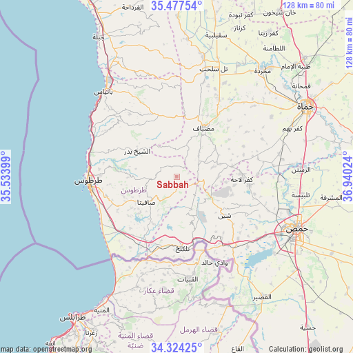
Sabbah GPS coordinates[2]
34° 54' 10.512" North, 36° 14' 13.596" East
| Map corner | latitude | longitude |
|---|---|---|
| Upper-left | 35.47754°, | 35.53399° |
| Center: | 34.90292°, | 36.23711° |
| Lower-right: | 34.32425°, | 36.94024° |
| Map W x H: | 128.2×128.2 km | = 79.7×79.7mi |
| max Lat: | 37.17701° ⇑58.7% North |
| Sabbah: | 34.90292° |
| min Lat: | ⇓41.3% South 32.39332° |
| min Long | Sabbah | max Long |
| 35.75572° | 36.23711° | 42.14006° |
| W 27.2%⇐ | ⇒72.8% E |
Elevation
Elevation of Sabbah is 643 m = 2110 ft, and this is 113.9 m = 374 ft above average elevation for this country.
| Max E: |
1640 m = 5381 ft | 28.3% |
| Sabbah | 643 m 2110 ft | |
| Avg. | 529.1 m = 1736 ft | |
Min E: |
4 m = 13 ft | 71.7% |
See also: Syria elevation on elevation.city.
Geographical zone
Sabbah is located in North temperate zone (between Tropic of Cancer and the Arctic Circle). Distance of this Northern Tropic circle is 1274.9 km =792.2 mi to South.| Distance of | km | miles | from Sabbah |
|---|---|---|---|
| North Pole | 6126.2 | 3806.6 | to North |
| Arctic Circle | 3520.3 | 2187.4 | to North |
| Tropic Cancer | 1274.9 | 792.2 | to South |
| Equator | 3880.8 | 2411.4 | to South |


Nearby cities:
15 places around Sabbah: (largest is in red/bold)
• Ad Duraykīsh
8.6 km =5.3 mi,  264°
264°
• Al Bāriqīyah
8.2 km =5.1 mi,  185°
185°
• Al Ḩawāsh
17.6 km =10.9 mi,  154°
154°
• An Nāşirah
13.6 km =8.5 mi,  160°
160°
• As Sīsnīyah
16 km =9.9 mi,  212°
212°
• Ash Shaykh Badr
17.1 km =10.6 mi,  305°
305°
• Brummānat al Mashāyikh
14.2 km =8.8 mi,  334°
334°
• Duwayr Raslān
7.2 km =4.5 mi,  315°
315°
• Junaynat Raslān
10.7 km =6.6 mi,  285°
285°
• Mashtá al Ḩulw
3.4 km =2.1 mi, 158°
• Satita
14.2 km =8.8 mi,  230°
230°
• Wādī al ‘Uyūn
11.8 km =7.3 mi,  337°
337°
• Ḩimmīn
18 km =11.2 mi,  269°
269°
• ‘Awaj
15.3 km =9.5 mi,  88°
88°
• ‘Ayn Ḩalāqīm
8.8 km =5.5 mi,  62°
62°
Sources, notices
• [Note1] Compared only with cities in Syria existing in our database
• [Src1] Map data: © OpenStreetMap contributors (CC-BY-SA)
• [Src2] Other city data from geonames.org with taken over terms of usage.
• [Src3] Geographical zone / Annual Mean Temperature by Robert A. Rohde @ Wikipedia
