Al Ḩamīdīyah geodata
Al Ḩamīdīyah (Tartus) is a seat of a third-order administrative division; located in Syria in Asia/Damascus (GMT+3) time zone. In our database, there are 87 cities with bigger population. Compared to other cities in Syria, 67.8% of cities are located further ↑North; 95.1% of cities are located further →East and 100% of cities have higher elevation than Al Ḩamīdīyah. Note1


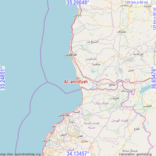
Al Ḩamīdīyah GPS coordinates[2]
34° 42' 52.38" North, 35° 57' 5.868" East
| Map corner | latitude | longitude |
|---|---|---|
| Upper-left | 35.29049°, | 35.24851° |
| Center: | 34.71455°, | 35.95163° |
| Lower-right: | 34.13457°, | 36.65476° |
| Map W x H: | 128.5×128.5 km | = 79.8×79.8mi |
| max Lat: | 37.17701° ⇑67.8% North |
| Al Ḩamīdīyah: | 34.71455° |
| min Lat: | ⇓32.2% South 32.39332° |
| min Long | Al Ḩamīdīya | max Long |
| 35.75572° | 35.95163° | 42.14006° |
| W 4.9%⇐ | ⇒95.1% E |
Elevation
Elevation of Al Ḩamīdīyah is 4 m = 13 ft, and this is 525.1 m = 1723 ft below average elevation for this country.
| Max E: |
1640 m = 5381 ft | 100% |
| Avg. | 529.1 m = 1736 ft | |
| Al Ḩamīdīyah | 4 m = 13 ft | |
Min E: |
4 m = 13 ft | 0% |
See also: Syria elevation on elevation.city.
Geographical zone
Al Ḩamīdīyah is located in North temperate zone (between Tropic of Cancer and the Arctic Circle). Distance of this Northern Tropic circle is 1254 km =779.2 mi to South.| Distance of | km | miles | from Al Ḩamīdīyah |
|---|---|---|---|
| North Pole | 6147.2 | 3819.7 | to North |
| Arctic Circle | 3541.3 | 2200.5 | to North |
| Tropic Cancer | 1254 | 779.2 | to South |
| Equator | 3859.9 | 2398.4 | to South |


Nearby cities:
15 places around Al Ḩamīdīyah: (largest is in red/bold)
• Ad Duraykīsh
26.6 km =16.5 mi,  41°
41°
• Al Bāriqīyah
28.3 km =17.6 mi,  63°
63°
• Al Karīmah
12.4 km =7.7 mi,  113°
113°
• An Nāşirah
31.6 km =19.6 mi,  75°
75°
• Arwād
17.9 km =11.1 mi,  331°
331°
• As Sawdā
29.7 km =18.5 mi,  358°
358°
• As Sīsnīyah
19 km =11.8 mi,  67°
67°
• Aş Şafşāfah
9.5 km =5.9 mi, 76°
• Junaynat Raslān
28.5 km =17.7 mi,  33°
33°
• Khirbat al Ma‘azzah
11 km =6.8 mi,  24°
24°
• Ra’s al Khashūfah
15.4 km =9.6 mi, 36°
• Satita
19.2 km =11.9 mi,  52°
52°
• Tallkalakh
28.7 km =17.8 mi,  100°
100°
• Tartouss
20.3 km =12.6 mi,  342°
342°
• Ḩimmīn
22.2 km =13.8 mi, 21°
Sources, notices
• [Note1] Compared only with cities in Syria existing in our database
• [Src1] Map data: © OpenStreetMap contributors (CC-BY-SA)
• [Src2] Other city data from geonames.org with taken over terms of usage.
• [Src3] Geographical zone / Annual Mean Temperature by Robert A. Rohde @ Wikipedia
