Wang Sombun geodata
Wang Sombun (Sa Kaeo) is a seat of a second-order administrative division; located in Thailand in Asia/Bangkok (GMT+7) time zone. In our database, there are 331 cities with bigger population. Compared to other cities in Thailand, 76.5% of cities are located further ↑North; 69.2% of cities are located further ←West and 51.7% of cities have lower elevation than Wang Sombun. Note1


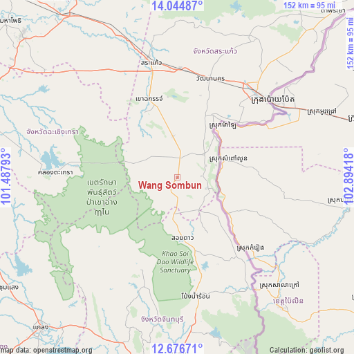
Wang Sombun GPS coordinates[2]
13° 21' 42.336" North, 102° 11' 27.78" East
| Map corner | latitude | longitude |
|---|---|---|
| Upper-left | 14.04487°, | 101.48793° |
| Center: | 13.36176°, | 102.19105° |
| Lower-right: | 12.67671°, | 102.89418° |
| Map W x H: | 152.1×152.1 km | = 94.5×94.5mi |
| max Lat: | 20.43353° ⇑76.5% North |
| Wang Sombun: | 13.36176° |
| min Lat: | ⇓23.5% South 5.77434° |
| min Long | Wang Sombun | max Long |
| 97.93288° | 102.19105° | 105.49506° |
| W 69.2%⇐ | ⇒30.8% E |
Elevation
Elevation of Wang Sombun is 119 m = 390 ft, and this is 6.5 m = 21 ft below average elevation for this country.
| Max E: |
1011 m = 3317 ft | 48.3% |
| Avg. | 125.5 m = 412 ft | |
| Wang Sombun | 119 m = 390 ft | |
Min E: |
1 m = 3 ft | 51.7% |
See also: Thailand elevation on elevation.city.
Geographical zone
Wang Sombun is located in North Torrid zone (between Equator and Tropic of Cancer). Distance of this Northern Tropic circle is 1120.2 km =696.1 mi to North.| Distance of | km | miles | from Wang Sombun |
|---|---|---|---|
| North Pole | 8521.4 | 5295 | to North |
| Arctic Circle | 5915.5 | 3675.7 | to North |
| Tropic Cancer | 1120.2 | 696.1 | to North |
| Equator | 1485.7 | 923.2 | to South |


Nearby cities:
15 places around Wang Sombun: (largest is in red/bold)
• Aranyaprathet
49.8 km =30.9 mi,  42°
42°
• Kaeng Hang Maeo
50 km =31.1 mi,  218°
218°
• Khao Chakan
34.3 km =21.3 mi,  341°
341°
• Khao Chamao
69.6 km =43.2 mi,  231°
231°
• Khao Khitchakut
62.5 km =38.8 mi,  187°
187°
• Khlong Hat
15.3 km =9.5 mi,  49°
49°
• Khok Sung
70.6 km =43.9 mi, 41°
• Makham
76.6 km =47.6 mi,  179°
179°
• Na Yai Am
75.9 km =47.2 mi,  211°
211°
• Pong Nam Ron
51.3 km =31.9 mi,  171°
171°
• Sa Kaeo
51.9 km =32.2 mi,  345°
345°
• Soi Dao
26 km =16.2 mi, 174°
• Tha Takiap
63.4 km =39.4 mi,  278°
278°
• Wang Nam Yen
15.8 km =9.8 mi,  356°
356°
• Watthana Nakhon
44.7 km =27.8 mi,  17°
17°
Sources, notices
• [Note1] Compared only with cities in Thailand existing in our database
• [Src1] Map data: © OpenStreetMap contributors (CC-BY-SA)
• [Src2] Other city data from geonames.org with taken over terms of usage.
• [Src3] Geographical zone / Annual Mean Temperature by Robert A. Rohde @ Wikipedia
