Tha Takiap geodata
Tha Takiap (Chachoengsao) is a seat of a second-order administrative division; located in Thailand in Asia/Bangkok (GMT+7) time zone. In our database, there are 331 cities with bigger population. Compared to other cities in Thailand, 75.7% of cities are located further ↑North; 62.1% of cities are located further ←West and 52% of cities have higher elevation than Tha Takiap. Note1


Tha Takiap GPS coordinates[2]
13° 26' 43.692" North, 101° 36' 40.788" East
| Map corner | latitude | longitude |
|---|---|---|
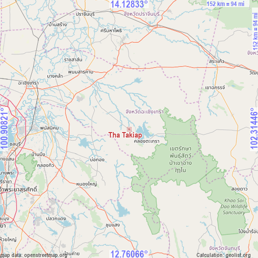
| Upper-left | 14.12833°, | 100.90821° |
| Center: | 13.44547°, | 101.61133° |
| Lower-right: | 12.76066°, | 102.31446° |
| Map W x H: | 152.1×152.1 km | = 94.5×94.5mi |
| max Lat: | 20.43353° ⇑75.7% North |
| Tha Takiap: | 13.44547° |
| min Lat: | ⇓24.3% South 5.77434° |
| min Long | Tha Takiap | max Long |
| 97.93288° | 101.61133° | 105.49506° |
| W 62.1%⇐ | ⇒37.9% E |
Elevation
Elevation of Tha Takiap is 73 m = 240 ft, and this is 52.5 m = 172 ft below average elevation for this country.
| Max E: |
1011 m = 3317 ft | 52% |
| Avg. | 125.5 m = 412 ft | |
| Tha Takiap | 73 m = 240 ft | |
Min E: |
1 m = 3 ft | 48% |
See also: Thailand elevation on elevation.city.
Geographical zone
Tha Takiap is located in North Torrid zone (between Equator and Tropic of Cancer). Distance of this Northern Tropic circle is 1110.9 km =690.3 mi to North.| Distance of | km | miles | from Tha Takiap |
|---|---|---|---|
| North Pole | 8512.1 | 5289.2 | to North |
| Arctic Circle | 5906.2 | 3669.9 | to North |
| Tropic Cancer | 1110.9 | 690.3 | to North |
| Equator | 1495 | 928.9 | to South |


Nearby cities:
15 places around Tha Takiap: (largest is in red/bold)
• Ban Bueng
56 km =34.8 mi,  254°
254°
• Bang Khla
53.3 km =33.1 mi,  305°
305°
• Bo Thong
26.2 km =16.3 mi,  224°
224°
• Kabin Buri
57.4 km =35.7 mi,  11°
11°
• Khao Chakan
56.5 km =35.1 mi,  65°
65°
• Khao Chamao
52.8 km =32.8 mi,  171°
171°
• Ko Chan
30.1 km =18.7 mi,  263°
263°
• Nong Yai
41.4 km =25.7 mi, 218°
• Phan Thong
55.9 km =34.7 mi,  272°
272°
• Phanat Nikhom
46.2 km =28.7 mi, 270°
• Phanom Sarakham
44.1 km =27.4 mi,  319°
319°
• Plaeng Yao
38.6 km =24 mi,  293°
293°
• Ratchasan
51.7 km =32.1 mi, 316°
• Sanam Chai Khet
30.1 km =18.7 mi, 321°
• Si Mahosot
54 km =33.6 mi,  335°
335°
Sources, notices
• [Note1] Compared only with cities in Thailand existing in our database
• [Src1] Map data: © OpenStreetMap contributors (CC-BY-SA)
• [Src2] Other city data from geonames.org with taken over terms of usage.
• [Src3] Geographical zone / Annual Mean Temperature by Robert A. Rohde @ Wikipedia
