Na Yai Am geodata
Na Yai Am (Chanthaburi) is a seat of a second-order administrative division; located in Thailand in Asia/Bangkok (GMT+7) time zone. In our database, there are 331 cities with bigger population. Compared to other cities in Thailand, 79.3% of cities are located further ↑North; 64.8% of cities are located further ←West and 73.7% of cities have higher elevation than Na Yai Am. Note1


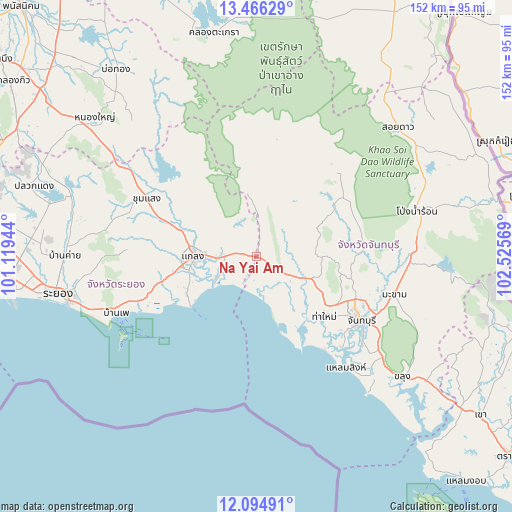
Na Yai Am GPS coordinates[2]
12° 46' 53.508" North, 101° 49' 21.216" East
| Map corner | latitude | longitude |
|---|---|---|
| Upper-left | 13.46629°, | 101.11944° |
| Center: | 12.78153°, | 101.82256° |
| Lower-right: | 12.09491°, | 102.52569° |
| Map W x H: | 152.5×152.5 km | = 94.8×94.8mi |
| max Lat: | 20.43353° ⇑79.3% North |
| Na Yai Am: | 12.78153° |
| min Lat: | ⇓20.7% South 5.77434° |
| min Long | Na Yai Am | max Long |
| 97.93288° | 101.82256° | 105.49506° |
| W 64.8%⇐ | ⇒35.2% E |
Elevation
Elevation of Na Yai Am is 16 m = 52 ft, and this is 109.5 m = 359 ft below average elevation for this country.
| Max E: |
1011 m = 3317 ft | 73.7% |
| Avg. | 125.5 m = 412 ft | |
| Na Yai Am | 16 m = 52 ft | |
Min E: |
1 m = 3 ft | 26.3% |
See also: Thailand elevation on elevation.city.
Geographical zone
Na Yai Am is located in North Torrid zone (between Equator and Tropic of Cancer). Distance of this Northern Tropic circle is 1184.7 km =736.1 mi to North.| Distance of | km | miles | from Na Yai Am |
|---|---|---|---|
| North Pole | 8585.9 | 5335 | to North |
| Arctic Circle | 5980 | 3715.8 | to North |
| Tropic Cancer | 1184.7 | 736.1 | to North |
| Equator | 1421.2 | 883.1 | to South |


Nearby cities:
15 places around Na Yai Am: (largest is in red/bold)
• Ban Khai
57.1 km =35.5 mi,  270°
270°
• Ban Phe
45.1 km =28 mi,  247°
247°
• Chanthaburi
36.1 km =22.4 mi,  122°
122°
• Kaeng Hang Maeo
26.8 km =16.7 mi,  19°
19°
• Khao Chamao
26.2 km =16.3 mi,  325°
325°
• Khao Khitchakut
31.8 km =19.8 mi,  85°
85°
• Khlung
56.5 km =35.1 mi,  130°
130°
• Klaeng
18.9 km =11.7 mi, 269°
• Laem Sing
43.1 km =26.8 mi,  140°
140°
• Makham
42.2 km =26.2 mi,  106°
106°
• Pong Nam Ron
49.6 km =30.8 mi,  73°
73°
• Rayong
62.2 km =38.6 mi,  259°
259°
• Soi Dao
57.4 km =35.7 mi,  47°
47°
• Tha Mai
26.6 km =16.5 mi, 132°
• Wang Chan
36.8 km =22.9 mi,  297°
297°
Sources, notices
• [Note1] Compared only with cities in Thailand existing in our database
• [Src1] Map data: © OpenStreetMap contributors (CC-BY-SA)
• [Src2] Other city data from geonames.org with taken over terms of usage.
• [Src3] Geographical zone / Annual Mean Temperature by Robert A. Rohde @ Wikipedia
