Khok Sung geodata
Khok Sung (Sa Kaeo) is a seat of a second-order administrative division; located in Thailand in Asia/Bangkok (GMT+7) time zone. In our database, there are 331 cities with bigger population. Compared to other cities in Thailand, 66.9% of cities are located further ↑North; 74.8% of cities are located further ←West and 53.3% of cities have higher elevation than Khok Sung. Note1


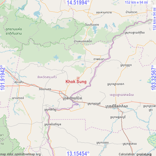
Khok Sung GPS coordinates[2]
13° 50' 17.664" North, 102° 37' 21.144" East
| Map corner | latitude | longitude |
|---|---|---|
| Upper-left | 14.51994°, | 101.91942° |
| Center: | 13.83824°, | 102.62254° |
| Lower-right: | 13.15454°, | 103.32567° |
| Map W x H: | 151.8×151.8 km | = 94.3×94.3mi |
| max Lat: | 20.43353° ⇑66.9% North |
| Khok Sung: | 13.83824° |
| min Lat: | ⇓33.1% South 5.77434° |
| min Long | Khok Sung | max Long |
| 97.93288° | 102.62254° | 105.49506° |
| W 74.8%⇐ | ⇒25.2% E |
Elevation
Elevation of Khok Sung is 66 m = 217 ft, and this is 59.5 m = 195 ft below average elevation for this country.
| Max E: |
1011 m = 3317 ft | 53.3% |
| Avg. | 125.5 m = 412 ft | |
| Khok Sung | 66 m = 217 ft | |
Min E: |
1 m = 3 ft | 46.7% |
See also: Thailand elevation on elevation.city.
Geographical zone
Khok Sung is located in North Torrid zone (between Equator and Tropic of Cancer). Distance of this Northern Tropic circle is 1067.3 km =663.2 mi to North.| Distance of | km | miles | from Khok Sung |
|---|---|---|---|
| North Pole | 8468.4 | 5262 | to North |
| Arctic Circle | 5862.5 | 3642.8 | to North |
| Tropic Cancer | 1067.3 | 663.2 | to North |
| Equator | 1538.7 | 956.1 | to South |


Nearby cities:
15 places around Khok Sung: (largest is in red/bold)
• Aranyaprathet
20.8 km =12.9 mi,  218°
218°
• Ban Kruat
82.9 km =51.5 mi,  38°
38°
• Khao Chakan
61.3 km =38.1 mi,  250°
250°
• Khlong Hat
55.4 km =34.4 mi, 219°
• Lahan Sai
68.7 km =42.7 mi,  21°
21°
• Non Din Daeng
54.6 km =33.9 mi,  14°
14°
• Non Suwan
82.6 km =51.3 mi,  358°
358°
• Pa Kham
67.6 km =42 mi, 9°
• Pakham
67.6 km =42 mi, 9°
• Sa Kaeo
59.5 km =37 mi,  267°
267°
• Soeng Sang
67.7 km =42.1 mi,  345°
345°
• Ta Phraya
26.9 km =16.7 mi,  47°
47°
• Wang Nam Yen
60.5 km =37.6 mi,  232°
232°
• Wang Sombun
70.6 km =43.9 mi, 221°
• Watthana Nakhon
34.4 km =21.4 mi, 252°
Sources, notices
• [Note1] Compared only with cities in Thailand existing in our database
• [Src1] Map data: © OpenStreetMap contributors (CC-BY-SA)
• [Src2] Other city data from geonames.org with taken over terms of usage.
• [Src3] Geographical zone / Annual Mean Temperature by Robert A. Rohde @ Wikipedia
