Taphan Hin geodata
Taphan Hin (Phichit) is a seat of a second-order administrative division; located in Thailand in Asia/Bangkok (GMT+7) time zone. With population of 21,895 people, there are 145 cities with bigger population in this country. Compared to other cities in Thailand, 68.8% of cities are located further ↓South; 61% of cities are located further →East and 63.3% of cities have higher elevation than Taphan Hin. Note1


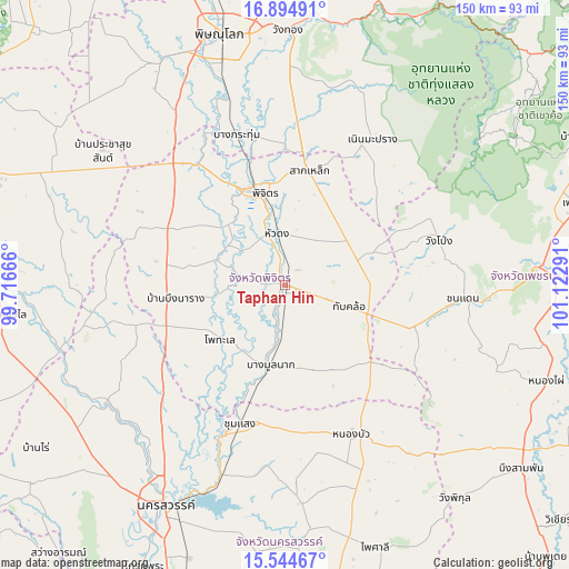
Taphan Hin GPS coordinates[2]
16° 13' 15.42" North, 100° 25' 11.208" East
| Map corner | latitude | longitude |
|---|---|---|
| Upper-left | 16.89491°, | 99.71666° |
| Center: | 16.22095°, | 100.41978° |
| Lower-right: | 15.54467°, | 101.12291° |
| Map W x H: | 150.1×150.1 km | = 93.3×93.3mi |
| max Lat: | 20.43353° ⇑31.2% North |
| Taphan Hin: | 16.22095° |
| min Lat: | ⇓68.8% South 5.77434° |
| min Long | Taphan Hin | max Long |
| 97.93288° | 100.41978° | 105.49506° |
| W 39%⇐ | ⇒61% E |
Elevation
Elevation of Taphan Hin is 36 m = 118 ft, and this is 89.5 m = 294 ft below average elevation for this country.
| Max E: |
1011 m = 3317 ft | 63.3% |
| Avg. | 125.5 m = 412 ft | |
| Taphan Hin | 36 m = 118 ft | |
Min E: |
1 m = 3 ft | 36.7% |
See also: Thailand elevation on elevation.city.
Geographical zone
Taphan Hin is located in North Torrid zone (between Equator and Tropic of Cancer). Distance of this Northern Tropic circle is 802.3 km =498.5 mi to North.| Distance of | km | miles | from Taphan Hin |
|---|---|---|---|
| North Pole | 8203.5 | 5097.4 | to North |
| Arctic Circle | 5597.6 | 3478.2 | to North |
| Tropic Cancer | 802.3 | 498.5 | to North |
| Equator | 1803.6 | 1120.7 | to South |


Nearby cities:
15 places around Taphan Hin: (largest is in red/bold)
• Bang Krathum
41.7 km =25.9 mi,  342°
342°
• Bang Mun Nak
21.9 km =13.6 mi,  191°
191°
• Bueng Na Rang
31.9 km =19.8 mi,  260°
260°
• Chumsaeng
38.5 km =23.9 mi,  198°
198°
• Dong Charoen
34.2 km =21.3 mi,  130°
130°
• Noen Maprang
44.7 km =27.8 mi,  30°
30°
• Nong Bua
43.4 km =27 mi,  155°
155°
• Phichit
25.7 km =16 mi, 342°
• Pho Thale
22.2 km =13.8 mi,  229°
229°
• Sak Lek
32.1 km =19.9 mi,  9°
9°
• Sam Ngam
39.2 km =24.4 mi,  324°
324°
• Thap Khlo
20.1 km =12.5 mi,  109°
109°
• Wachira Barami
44.6 km =27.7 mi, 318°
• Wang Pong
42 km =26.1 mi,  71°
71°
• Wang Sai Phun
22.5 km =14 mi, 34°
Sources, notices
• [Note1] Compared only with cities in Thailand existing in our database
• [Src1] Map data: © OpenStreetMap contributors (CC-BY-SA)
• [Src2] Other city data from geonames.org with taken over terms of usage.
• [Src3] Geographical zone / Annual Mean Temperature by Robert A. Rohde @ Wikipedia
