Klaeng geodata
Klaeng (Rayong) is a seat of a second-order administrative division; located in Thailand in Asia/Bangkok (GMT+7) time zone. With population of 55,619 people, there are 47 cities with bigger population in this country. Compared to other cities in Thailand, 79.4% of cities are located further ↑North; 62.4% of cities are located further ←West and 83.5% of cities have higher elevation than Klaeng. Note1


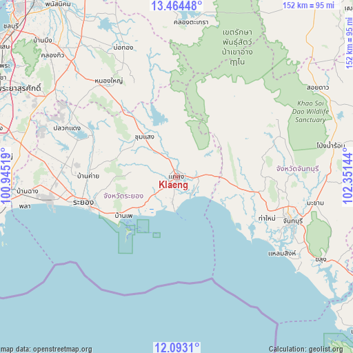
Klaeng GPS coordinates[2]
12° 46' 46.992" North, 101° 38' 53.916" East
| Map corner | latitude | longitude |
|---|---|---|
| Upper-left | 13.46448°, | 100.94519° |
| Center: | 12.77972°, | 101.64831° |
| Lower-right: | 12.0931°, | 102.35144° |
| Map W x H: | 152.5×152.5 km | = 94.8×94.8mi |
| max Lat: | 20.43353° ⇑79.4% North |
| Klaeng: | 12.77972° |
| min Lat: | ⇓20.6% South 5.77434° |
| min Long | Klaeng | max Long |
| 97.93288° | 101.64831° | 105.49506° |
| W 62.4%⇐ | ⇒37.6% E |
Elevation
Elevation of Klaeng is 11 m = 36 ft, and this is 114.5 m = 376 ft below average elevation for this country.
| Max E: |
1011 m = 3317 ft | 83.5% |
| Avg. | 125.5 m = 412 ft | |
| Klaeng | 11 m = 36 ft | |
Min E: |
1 m = 3 ft | 16.5% |
See also: Klaeng elevation on elevation.city.
Geographical zone
Klaeng is located in North Torrid zone (between Equator and Tropic of Cancer). Distance of this Northern Tropic circle is 1184.9 km =736.3 mi to North.| Distance of | km | miles | from Klaeng |
|---|---|---|---|
| North Pole | 8586.1 | 5335.2 | to North |
| Arctic Circle | 5980.2 | 3715.9 | to North |
| Tropic Cancer | 1184.9 | 736.3 | to North |
| Equator | 1421 | 883 | to South |


Nearby cities:
15 places around Klaeng: (largest is in red/bold)
• Ban Khai
38.2 km =23.7 mi,  270°
270°
• Ban Phe
28.4 km =17.6 mi,  233°
233°
• Bo Thong
59.8 km =37.2 mi,  337°
337°
• Chanthaburi
53 km =32.9 mi,  110°
110°
• Kaeng Hang Maeo
37.8 km =23.5 mi,  47°
47°
• Khao Chamao
22.2 km =13.8 mi,  10°
10°
• Khao Khitchakut
50.7 km =31.5 mi,  86°
86°
• Laem Sing
56.8 km =35.3 mi,  125°
125°
• Na Yai Am
18.9 km =11.7 mi, 89°
• Nikhom Phattana
48.6 km =30.2 mi,  276°
276°
• Nong Yai
51.4 km =31.9 mi,  324°
324°
• Pluak Daeng
51.6 km =32.1 mi,  294°
294°
• Rayong
43.7 km =27.2 mi,  255°
255°
• Tha Mai
42.5 km =26.4 mi, 114°
• Wang Chan
22.1 km =13.7 mi, 322°
Sources, notices
• [Note1] Compared only with cities in Thailand existing in our database
• [Src1] Map data: © OpenStreetMap contributors (CC-BY-SA)
• [Src2] Other city data from geonames.org with taken over terms of usage.
• [Src3] Geographical zone / Annual Mean Temperature by Robert A. Rohde @ Wikipedia
