Tha Mai geodata
Tha Mai (Chanthaburi) is a seat of a second-order administrative division; located in Thailand in Asia/Bangkok (GMT+7) time zone. With population of 22,445 people, there are 140 cities with bigger population in this country. Compared to other cities in Thailand, 80% of cities are located further ↑North; 66.7% of cities are located further ←West and 99.3% of cities have higher elevation than Tha Mai. Note1


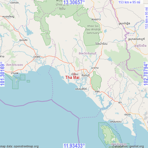
Tha Mai GPS coordinates[2]
12° 37' 16.932" North, 102° 0' 17.316" East
| Map corner | latitude | longitude |
|---|---|---|
| Upper-left | 13.30657°, | 101.30169° |
| Center: | 12.62137°, | 102.00481° |
| Lower-right: | 11.93433°, | 102.70794° |
| Map W x H: | 152.6×152.6 km | = 94.8×94.8mi |
| max Lat: | 20.43353° ⇑80% North |
| Tha Mai: | 12.62137° |
| min Lat: | ⇓20% South 5.77434° |
| min Long | Tha Mai | max Long |
| 97.93288° | 102.00481° | 105.49506° |
| W 66.7%⇐ | ⇒33.3% E |
Elevation
Elevation of Tha Mai is 4 m = 13 ft, and this is 121.5 m = 399 ft below average elevation for this country.
| Max E: |
1011 m = 3317 ft | 99.3% |
| Avg. | 125.5 m = 412 ft | |
| Tha Mai | 4 m = 13 ft | |
Min E: |
1 m = 3 ft | 0.7% |
See also: Thailand elevation on elevation.city.
Geographical zone
Tha Mai is located in North Torrid zone (between Equator and Tropic of Cancer). Distance of this Northern Tropic circle is 1202.6 km =747.3 mi to North.| Distance of | km | miles | from Tha Mai |
|---|---|---|---|
| North Pole | 8603.7 | 5346.1 | to North |
| Arctic Circle | 5997.8 | 3726.9 | to North |
| Tropic Cancer | 1202.6 | 747.3 | to North |
| Equator | 1403.4 | 872 | to South |


Nearby cities:
15 places around Tha Mai: (largest is in red/bold)
• Ban Phe
61.6 km =38.3 mi,  270°
270°
• Bo Rai
58 km =36 mi,  95°
95°
• Chanthaburi
10.9 km =6.8 mi, 96°
• Kaeng Hang Maeo
44.3 km =27.5 mi,  346°
346°
• Khao Chamao
52.5 km =32.6 mi,  318°
318°
• Khao Khitchakut
23.6 km =14.7 mi,  30°
30°
• Khao Saming
55.4 km =34.4 mi,  122°
122°
• Khlung
29.9 km =18.6 mi,  128°
128°
• Klaeng
42.5 km =26.4 mi,  294°
294°
• Laem Sing
17.2 km =10.7 mi,  154°
154°
• Makham
21.5 km =13.4 mi,  74°
74°
• Na Yai Am
26.6 km =16.5 mi,  312°
312°
• Pong Nam Ron
42.2 km =26.2 mi,  41°
41°
• Soi Dao
60.8 km =37.8 mi,  21°
21°
• Wang Chan
62.9 km =39.1 mi,  303°
303°
Sources, notices
• [Note1] Compared only with cities in Thailand existing in our database
• [Src1] Map data: © OpenStreetMap contributors (CC-BY-SA)
• [Src2] Other city data from geonames.org with taken over terms of usage.
• [Src3] Geographical zone / Annual Mean Temperature by Robert A. Rohde @ Wikipedia
