Khueang Nai geodata
Khueang Nai (Changwat Ubon Ratchathani) is a seat of a second-order administrative division; located in Thailand in Asia/Bangkok (GMT+7) time zone. In our database, there are 331 cities with bigger population. Compared to other cities in Thailand, 56.8% of cities are located further ↓South; 95.6% of cities are located further ←West and 53.3% of cities have lower elevation than Khueang Nai. Note1


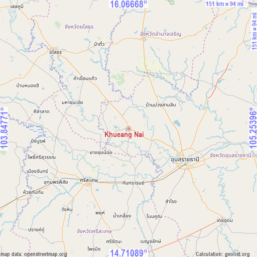
Khueang Nai GPS coordinates[2]
15° 23' 23.604" North, 104° 33' 2.988" East
| Map corner | latitude | longitude |
|---|---|---|
| Upper-left | 16.06668°, | 103.84771° |
| Center: | 15.38989°, | 104.55083° |
| Lower-right: | 14.71089°, | 105.25396° |
| Map W x H: | 150.7×150.8 km | = 93.6×93.7mi |
| max Lat: | 20.43353° ⇑43.2% North |
| Khueang Nai: | 15.38989° |
| min Lat: | ⇓56.8% South 5.77434° |
| min Long | Khueang Nai | max Long |
| 97.93288° | 104.55083° | 105.49506° |
| W 95.6%⇐ | ⇒4.4% E |
Elevation
Elevation of Khueang Nai is 131 m = 430 ft, and this is 5.5 m = 18 ft above average elevation for this country.
| Max E: |
1011 m = 3317 ft | 46.7% |
| Khueang Nai | 131 m 430 ft | |
| Avg. | 125.5 m = 412 ft | |
Min E: |
1 m = 3 ft | 53.3% |
See also: Thailand elevation on elevation.city.
Geographical zone
Khueang Nai is located in North Torrid zone (between Equator and Tropic of Cancer). Distance of this Northern Tropic circle is 894.7 km =555.9 mi to North.| Distance of | km | miles | from Khueang Nai |
|---|---|---|---|
| North Pole | 8295.9 | 5154.8 | to North |
| Arctic Circle | 5690 | 3535.6 | to North |
| Tropic Cancer | 894.7 | 555.9 | to North |
| Equator | 1711.2 | 1063.3 | to South |


Nearby cities:
15 places around Khueang Nai: (largest is in red/bold)
• Hua Taphan
34.7 km =21.6 mi,  349°
349°
• Kanthararom
32 km =19.9 mi,  175°
175°
• Kham Khuean Kaeo
39.1 km =24.3 mi,  318°
318°
• Kho Wang
21.4 km =13.3 mi,  264°
264°
• Lao Suea Kok
40.1 km =24.9 mi,  85°
85°
• Lue Amnat
35.5 km =22.1 mi,  17°
17°
• Maha Chana Chai
36.9 km =22.9 mi,  294°
294°
• Muang Sam Sip
23.2 km =14.4 mi,  53°
53°
• Phana
45.4 km =28.2 mi,  44°
44°
• Rasi Salai
42.8 km =26.6 mi, 263°
• Samrong
49.3 km =30.6 mi,  149°
149°
• Si Sa Ket
38.7 km =24 mi,  217°
217°
• Ubon Ratchathani
36.1 km =22.4 mi,  117°
117°
• Warin Chamrap
40 km =24.9 mi, 123°
• Yang Chum Noi
21.5 km =13.4 mi,  229°
229°
Sources, notices
• [Note1] Compared only with cities in Thailand existing in our database
• [Src1] Map data: © OpenStreetMap contributors (CC-BY-SA)
• [Src2] Other city data from geonames.org with taken over terms of usage.
• [Src3] Geographical zone / Annual Mean Temperature by Robert A. Rohde @ Wikipedia
