Kho Wang geodata
Kho Wang (Yasothon) is a seat of a second-order administrative division; located in Thailand in Asia/Bangkok (GMT+7) time zone. In our database, there are 331 cities with bigger population. Compared to other cities in Thailand, 56.4% of cities are located further ↓South; 94.1% of cities are located further ←West and 55.4% of cities have lower elevation than Kho Wang. Note1


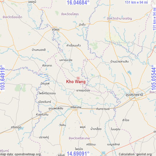
Kho Wang GPS coordinates[2]
15° 22' 11.928" North, 104° 21' 8.316" East
| Map corner | latitude | longitude |
|---|---|---|
| Upper-left | 16.04684°, | 103.64919° |
| Center: | 15.36998°, | 104.35231° |
| Lower-right: | 14.69091°, | 105.05544° |
| Map W x H: | 150.8×150.8 km | = 93.7×93.7mi |
| max Lat: | 20.43353° ⇑43.6% North |
| Kho Wang: | 15.36998° |
| min Lat: | ⇓56.4% South 5.77434° |
| min Long | Kho Wang | max Long |
| 97.93288° | 104.35231° | 105.49506° |
| W 94.1%⇐ | ⇒5.9% E |
Elevation
Elevation of Kho Wang is 137 m = 449 ft, and this is 11.5 m = 38 ft above average elevation for this country.
| Max E: |
1011 m = 3317 ft | 44.6% |
| Kho Wang | 137 m 449 ft | |
| Avg. | 125.5 m = 412 ft | |
Min E: |
1 m = 3 ft | 55.4% |
See also: Thailand elevation on elevation.city.
Geographical zone
Kho Wang is located in North Torrid zone (between Equator and Tropic of Cancer). Distance of this Northern Tropic circle is 896.9 km =557.3 mi to North.| Distance of | km | miles | from Kho Wang |
|---|---|---|---|
| North Pole | 8298.1 | 5156.2 | to North |
| Arctic Circle | 5692.2 | 3537 | to North |
| Tropic Cancer | 896.9 | 557.3 | to North |
| Equator | 1709 | 1061.9 | to South |


Nearby cities:
15 places around Kho Wang: (largest is in red/bold)
• Bueng Bun
33.3 km =20.7 mi,  262°
262°
• Hua Taphan
39.3 km =24.4 mi,  22°
22°
• Kanthararom
38 km =23.6 mi,  141°
141°
• Kham Khuean Kaeo
31.7 km =19.7 mi,  351°
351°
• Khueang Nai
21.4 km =13.3 mi,  84°
84°
• Maha Chana Chai
21.5 km =13.4 mi,  325°
325°
• Mueang Chan
41.2 km =25.6 mi,  235°
235°
• Phanom Phrai
42.9 km =26.7 mi,  322°
322°
• Pho Si Suwan
33.4 km =20.8 mi, 242°
• Phon Sai
40.3 km =25 mi,  288°
288°
• Rasi Salai
21.4 km =13.3 mi, 262°
• Si Sa Ket
28.5 km =17.7 mi,  184°
184°
• Sila Lat
32.1 km =19.9 mi, 290°
• Uthumphon Phisai
36.7 km =22.8 mi,  218°
218°
• Yang Chum Noi
12.7 km =7.9 mi,  157°
157°
Sources, notices
• [Note1] Compared only with cities in Thailand existing in our database
• [Src1] Map data: © OpenStreetMap contributors (CC-BY-SA)
• [Src2] Other city data from geonames.org with taken over terms of usage.
• [Src3] Geographical zone / Annual Mean Temperature by Robert A. Rohde @ Wikipedia
