Huai Thap Than geodata
Huai Thap Than (Sisaket) is a seat of a second-order administrative division; located in Thailand in Asia/Bangkok (GMT+7) time zone. In our database, there are 331 cities with bigger population. Compared to other cities in Thailand, 51% of cities are located further ↓South; 90.6% of cities are located further ←West and 54.8% of cities have lower elevation than Huai Thap Than. Note1


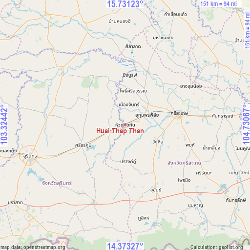
Huai Thap Than GPS coordinates[2]
15° 3' 11.988" North, 104° 1' 39.144" East
| Map corner | latitude | longitude |
|---|---|---|
| Upper-left | 15.73123°, | 103.32442° |
| Center: | 15.05333°, | 104.02754° |
| Lower-right: | 14.37327°, | 104.73067° |
| Map W x H: | 151×151 km | = 93.8×93.8mi |
| max Lat: | 20.43353° ⇑49% North |
| Huai Thap Than: | 15.05333° |
| min Lat: | ⇓51% South 5.77434° |
| min Long | Huai Thap Than | max Long |
| 97.93288° | 104.02754° | 105.49506° |
| W 90.6%⇐ | ⇒9.4% E |
Elevation
Elevation of Huai Thap Than is 136 m = 446 ft, and this is 10.5 m = 34 ft above average elevation for this country.
| Max E: |
1011 m = 3317 ft | 45.2% |
| Huai Thap Than | 136 m 446 ft | |
| Avg. | 125.5 m = 412 ft | |
Min E: |
1 m = 3 ft | 54.8% |
See also: Thailand elevation on elevation.city.
Geographical zone
Huai Thap Than is located in North Torrid zone (between Equator and Tropic of Cancer). Distance of this Northern Tropic circle is 932.1 km =579.2 mi to North.| Distance of | km | miles | from Huai Thap Than |
|---|---|---|---|
| North Pole | 8333.3 | 5178.1 | to North |
| Arctic Circle | 5727.4 | 3558.8 | to North |
| Tropic Cancer | 932.1 | 579.2 | to North |
| Equator | 1673.8 | 1040.1 | to South |


Nearby cities:
15 places around Huai Thap Than: (largest is in red/bold)
• Bueng Bun
30.9 km =19.2 mi,  3°
3°
• Khu Khan
42 km =26.1 mi,  154°
154°
• Mueang Chan
11.8 km =7.3 mi, 4°
• Non Narai
23.9 km =14.9 mi,  329°
329°
• Pho Si Suwan
20.3 km =12.6 mi,  15°
15°
• Prang Ku
21.9 km =13.6 mi,  176°
176°
• Rasi Salai
35.2 km =21.9 mi, 22°
• Rattanaburi
35.1 km =21.8 mi, 326°
• Samrong Thap
10.4 km =6.5 mi,  250°
250°
• Sanom
33.2 km =20.6 mi,  300°
300°
• Si Khoraphum
27.6 km =17.1 mi,  243°
243°
• Si Narong
35.8 km =22.2 mi,  207°
207°
• Si Sa Ket
33.1 km =20.6 mi,  78°
78°
• Uthumphon Phisai
13.7 km =8.5 mi,  61°
61°
• Wang Hin
24.8 km =15.4 mi,  118°
118°
Sources, notices
• [Note1] Compared only with cities in Thailand existing in our database
• [Src1] Map data: © OpenStreetMap contributors (CC-BY-SA)
• [Src2] Other city data from geonames.org with taken over terms of usage.
• [Src3] Geographical zone / Annual Mean Temperature by Robert A. Rohde @ Wikipedia
