Si Khoraphum geodata
Si Khoraphum (Surin) is a seat of a second-order administrative division; located in Thailand in Asia/Bangkok (GMT+7) time zone. In our database, there are 331 cities with bigger population. Compared to other cities in Thailand, 51% of cities are located further ↑North; 88.2% of cities are located further ←West and 57.8% of cities have lower elevation than Si Khoraphum. Note1


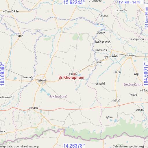
Si Khoraphum GPS coordinates[2]
14° 56' 39.048" North, 103° 47' 49.344" East
| Map corner | latitude | longitude |
|---|---|---|
| Upper-left | 15.62243°, | 103.09392° |
| Center: | 14.94418°, | 103.79704° |
| Lower-right: | 14.26378°, | 104.50017° |
| Map W x H: | 151.1×151.1 km | = 93.9×93.9mi |
| max Lat: | 20.43353° ⇑51% North |
| Si Khoraphum: | 14.94418° |
| min Lat: | ⇓49% South 5.77434° |
| min Long | Si Khoraphum | max Long |
| 97.93288° | 103.79704° | 105.49506° |
| W 88.2%⇐ | ⇒11.8% E |
Elevation
Elevation of Si Khoraphum is 143 m = 469 ft, and this is 17.5 m = 57 ft above average elevation for this country.
| Max E: |
1011 m = 3317 ft | 42.2% |
| Si Khoraphum | 143 m 469 ft | |
| Avg. | 125.5 m = 412 ft | |
Min E: |
1 m = 3 ft | 57.8% |
See also: Thailand elevation on elevation.city.
Geographical zone
Si Khoraphum is located in North Torrid zone (between Equator and Tropic of Cancer). Distance of this Northern Tropic circle is 944.3 km =586.8 mi to North.| Distance of | km | miles | from Si Khoraphum |
|---|---|---|---|
| North Pole | 8345.4 | 5185.6 | to North |
| Arctic Circle | 5739.5 | 3566.4 | to North |
| Tropic Cancer | 944.3 | 586.8 | to North |
| Equator | 1661.6 | 1032.5 | to South |


Nearby cities:
15 places around Si Khoraphum: (largest is in red/bold)
• Chom Phra
28.1 km =17.5 mi,  313°
313°
• Huai Thap Than
27.6 km =17.1 mi,  63°
63°
• Khwao Sinarin
23 km =14.3 mi,  286°
286°
• Lamduan
28.3 km =17.6 mi,  209°
209°
• Mueang Chan
35.1 km =21.8 mi,  46°
46°
• Non Narai
34.9 km =21.7 mi,  20°
20°
• Pho Si Suwan
43.7 km =27.2 mi,  43°
43°
• Prang Ku
27.8 km =17.3 mi,  110°
110°
• Rattanaburi
41.9 km =26 mi,  7°
7°
• Samrong Thap
17.3 km =10.7 mi, 59°
• Sangkha
34.8 km =21.6 mi,  170°
170°
• Sanom
29.1 km =18.1 mi,  352°
352°
• Si Narong
21.3 km =13.2 mi,  157°
157°
• Surin
33.3 km =20.7 mi,  257°
257°
• Uthumphon Phisai
41.3 km =25.7 mi, 63°
Sources, notices
• [Note1] Compared only with cities in Thailand existing in our database
• [Src1] Map data: © OpenStreetMap contributors (CC-BY-SA)
• [Src2] Other city data from geonames.org with taken over terms of usage.
• [Src3] Geographical zone / Annual Mean Temperature by Robert A. Rohde @ Wikipedia
